Trip Summary: Nevada, Arizona and the West Parks
Posted 2026-03-15
Last Thanksgiving I traveled to the west side of the US for my first time for around 2 weeks, flying into Las Vegas and visiting the surrounding parks.
This is me writing it from memory recollection. I started initially writing this from the end of December, and now it’s the middle of March where I am publishing this. Mainly because I couldn’t get around to writing this, and was lazy to do so. While some details are murky in my mind, hopefully I captured the majority of what occurred. I may update this blog over time with pictures or corrections.
The pictures shown here might just be out of my phone or my camera JPEG preview, i.e they might look like crap. Full post-processed images will slowly make their way unto my photography website.
Day 0 - Flight In
The first day was Friday at ~10pm when my JetBlue flight departed off JFK headed to LAS. A couple of weeks ago I was partially worried my flight would be canceled due to the government shutdown, but thankfully that did not happen.
The flight was thankfully uneventful. This specific plane seemed to be an older model, as I’ve noticed that the entertainment monitor seemed a bit analog-y, not completely pixel sharp kind of look. I would not be surprised if it’s some composite video running to those screens. One of the available snacks on this flight was Goldfish, which beats other airline snacks that I’ve seen. Plus one for JetBlue.
Upon landing, which was earlier than scheduled, walking around the airport I saw several slot machines. Great start on gambling. I and a bunch of others had to wait for an hour to get our car rental. It seemed like their systems were crapping out for some time. The vehicle I got was a Jeep Compass, which I wasn’t initially too happy about due to it’s lack of gas efficiency, and I knew I would be doing a lot of driving. But I decided that it was probably fine.
After that to the hotel it was. Hilton Garden Inn Las Vegas Strip South, nothing too special.
Day 1 - Red Rock Canyon Park
On the first full day in Vegas, I decided to head to the Red Rock Canyon. For breakfast I stopped by some placed called Whidbey’s. It was a nice local (I think) breakfast place, the omelets I got tasted all right.
Headed to the park, I was amazed at the…well…red rocks. Coming from the east coast, we don’t have multi-colored rocks, so this was my first time seeings such things.

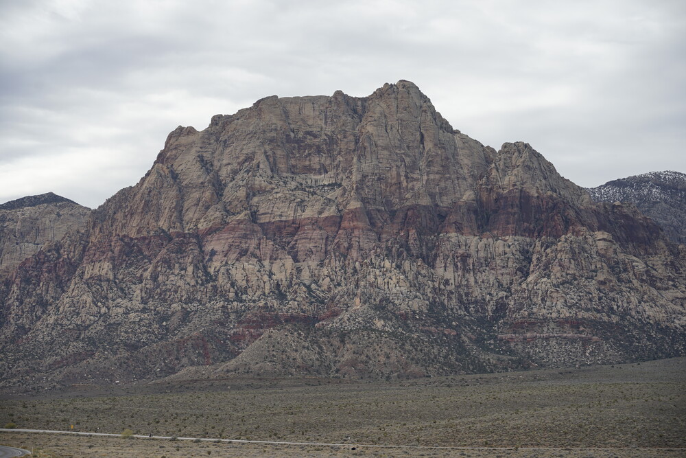
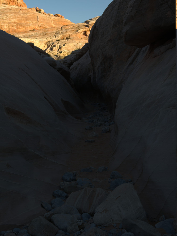
I purchased a last minute ticket to the scenic drive, which is where many of the trails were at. My first stop was Calico 1. I decided to go in the on the right side trail and a bit off the trail, with minor climbing of rocks. At some point in between, I got to experience full silence. No wind, no bird, no human chatter, just the noise floor of my ears. Quite astounding. I may or may not have gone into more riskier climbs where, if I wasn’t careful on the way down, could have slipped and fell, which would not have been fun. Thankfully I made it back to the parking lot, where I made my way to the left side of the trail, which only then I realized was the actual trail walk.
After that I decided to stop by the Sandstone Quarry Overlook and walk on the Calico Tanks trail. This was later during the day, so while I did get nearly to the end, it was slightly past sunset by then, and I was getting worried about the walk back, so I decided to head back. I think I was only 5-10 minutes away from the trail end. By the time I got back to my car it was dark enough where if I did stay the extra 5-10 minutes, I probably would have been worse off.
On the drive back continuing on the scenic road, I noticed a red battery indicator. This indicator actually popped up during my drive into the park, but didn’t think much of it at the time. I stopped by Costco and get some water and snacks for my trip (go trail mix), and looked up what the indicator meant, which turns out isn’t a minor warning. After getting what I wanted from Costco, I headed by the to the car rental place, which was 5 minutes from my hotel anyways, and let them know in case it was a bigger problem given I will be out in the middle of nowhere in the coming days. They decided to switch out vehicles for me just in case. My replacement was a Nissan Altima, which was much more efficient than the Jeep, so I was happy about that.
Day 2 - Drive to Beatty
This day I had to drive up to Beatty, NV where I would be staying for Death Valley for a couple of days.
For breakfast I drove up to Blooming Buns Bakehouse, which was right off the highway I had to be on. They had really good vietnamese coffee, and really good “Brionuts”, which were stuffed donuts of their making. A bit on the expensive side, but worth it.
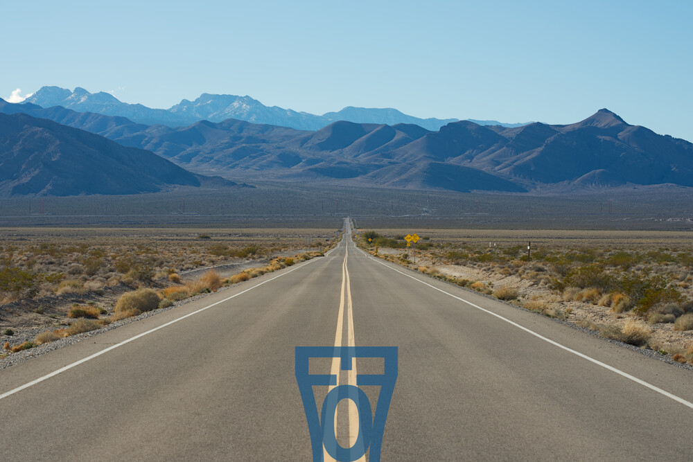
After I stopped by the Desert National Wildlife Refuge. It was a neat place to check out, with a long straight road leading there.
I did not encounter any large animals on the short walk they designated, but some family with a young daughter was handing out flowers she probably picked off somewhere to those walking by. I found it cute.
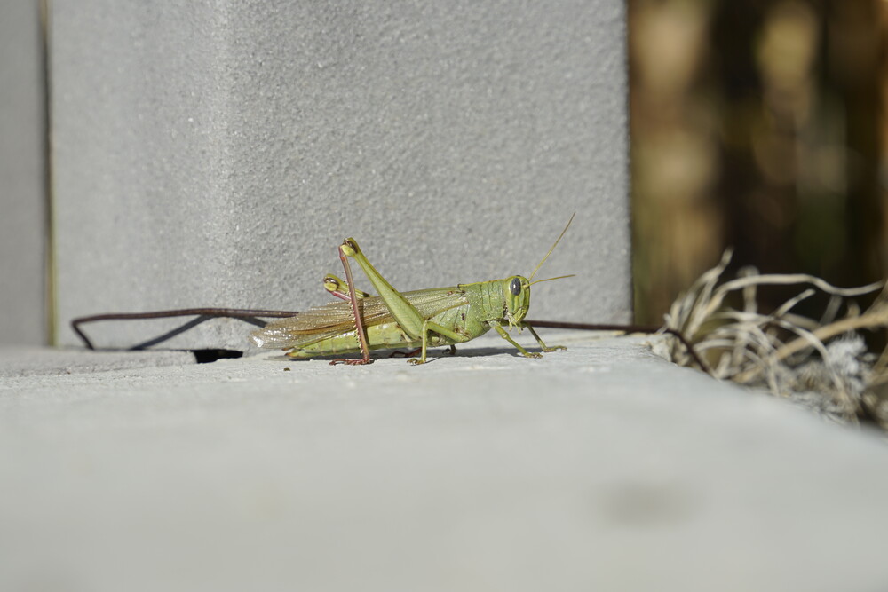
I also came across this cool grasshopper.
After that was the drive to Beatty. There was some interesting scenery on the drive there, stuff that I haven’t seen before. The area was also more plant-filled than I expected, and more mountainous. For some reason I had the mental image of a plain flat desert around that area.
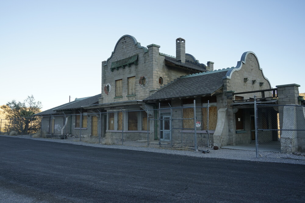
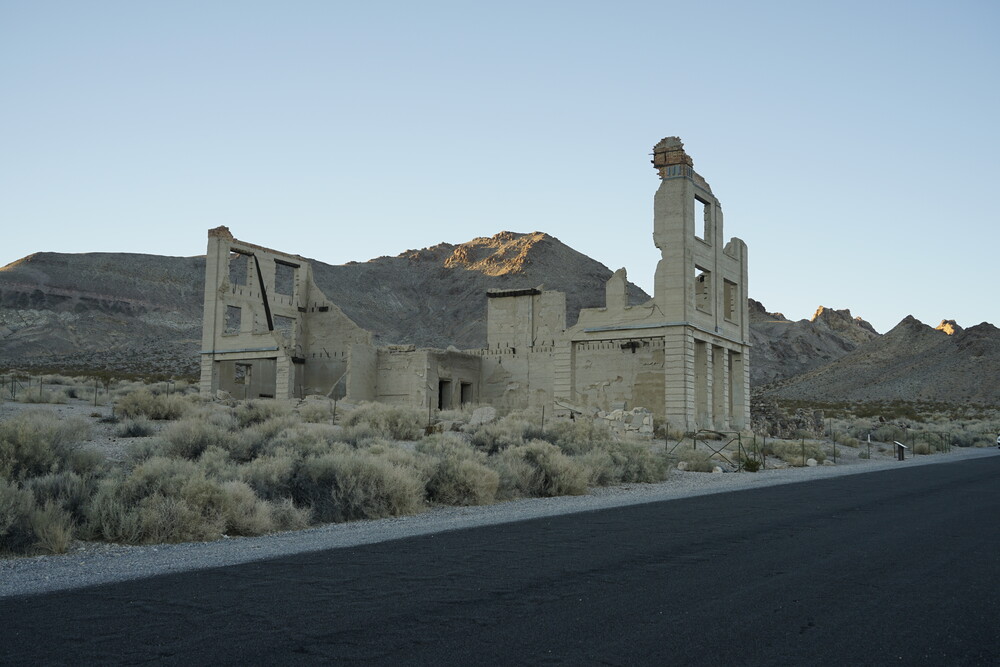
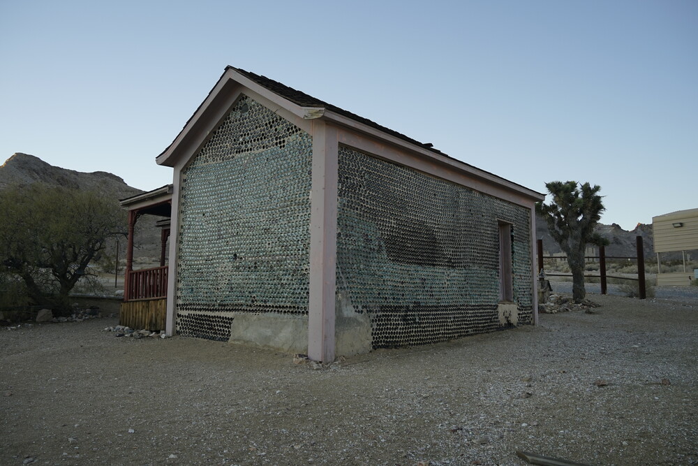
Arriving at Beatty I stayed at the Exchange Club Motel. Quite a nice hotel, nothing too special. The town is quite small, at compared to what my reference point for a town is. After putting my stuff down, I drove to Rhyolite, which is an abandoned mining town that had a boom in the 1910’s, for approximately 5-10 years. Talk about a short lifespan. An interesting historical area, including a house made out of bottles. Apparently this wasn’t that uncommon, as bottles were readily available and they trapped heat in the winter letting sunlight through. Smart.
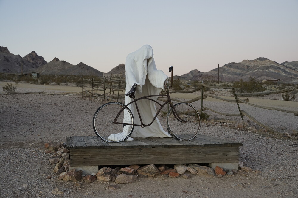
The open air museum nearby was…interesting.
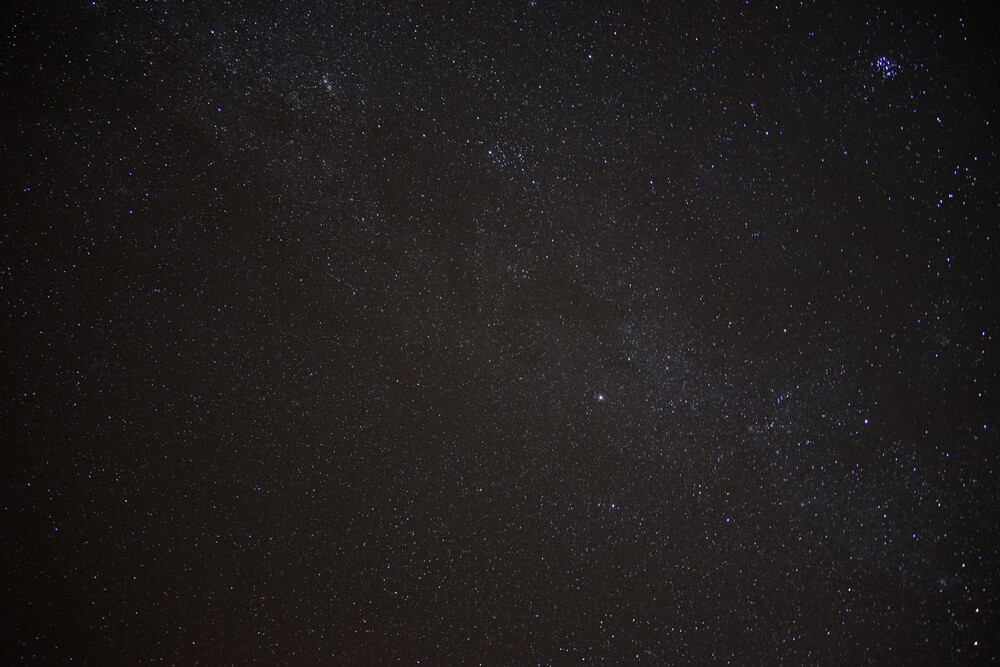
After a couple of hours at my hotel, I decided to drive out to literally the middle of nowhere on the road to take some pictures, like 10-15 minutes away from the hotel. I used a light pollution map to determine the least polluted areas. The first time I went up and stopped, I found out that I forgot about my camera. Genius. I still stared out a bit into the night sky, and was astounded. I have never seen so many stars beforehand, and my eyes still weren’t 100% open due to the passing by car’s headlights. I was also partially scared, as it was just me next to my car, with the unknown out there.
Keep in mind it was a new moon, so there was literally no other light sky.
I drove back, got my camera, and drove back to an area a bit closer to where I stopped the first time. I had my tripod and camera setup taking some pictures, but I stayed in the car during the long exposures. Both due to the cold, and the fear of the unknown. I would periodically come out when the trigger finished to start a new one.
Day 3 - Death Valley
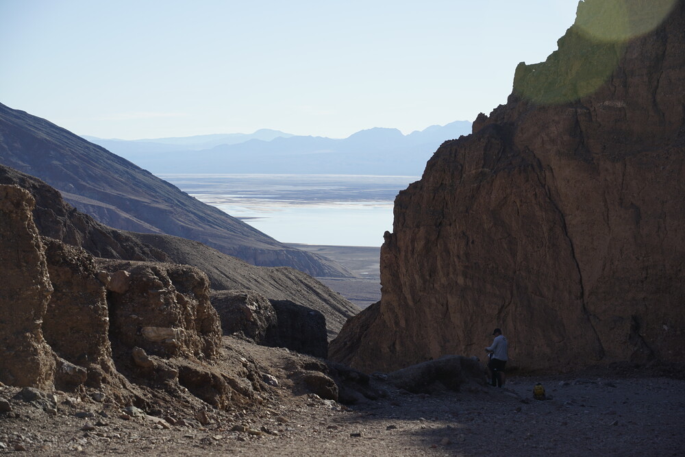
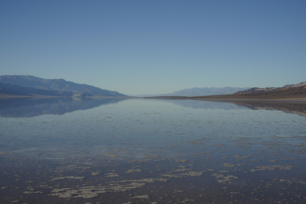
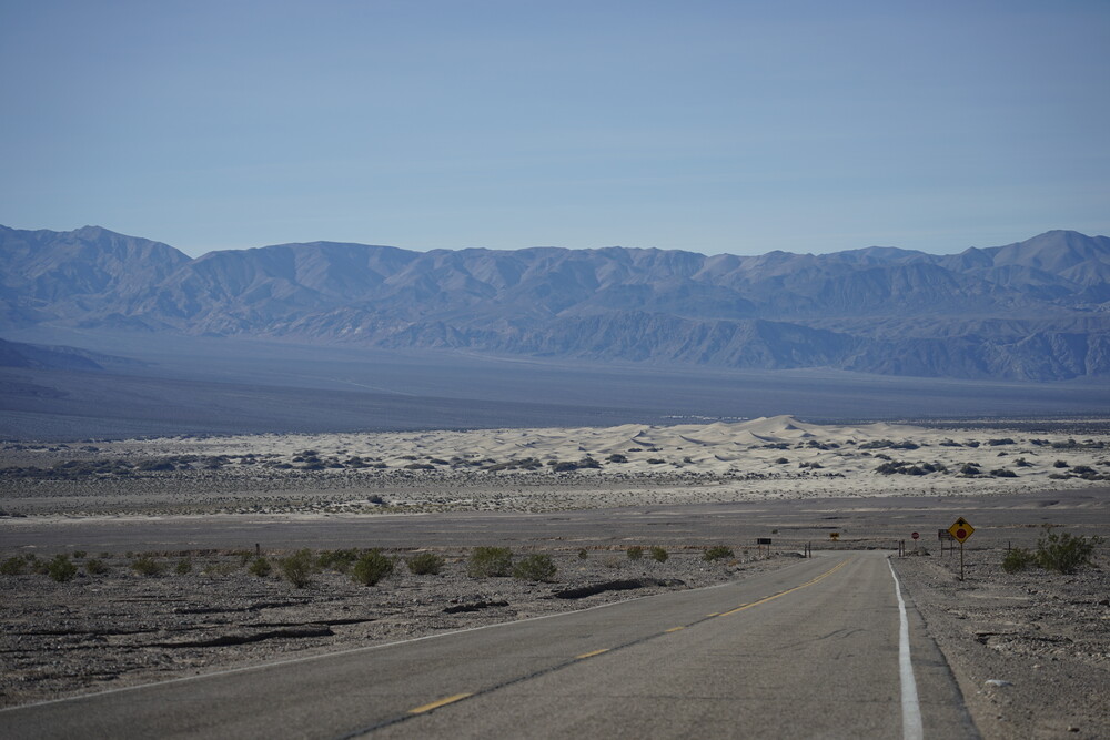
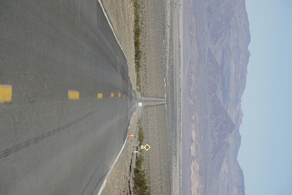
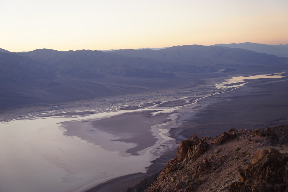
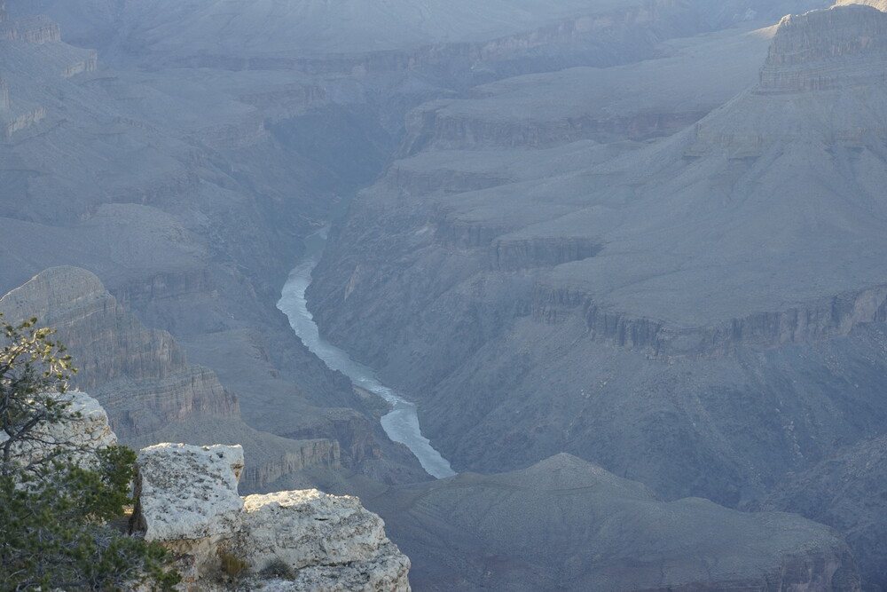
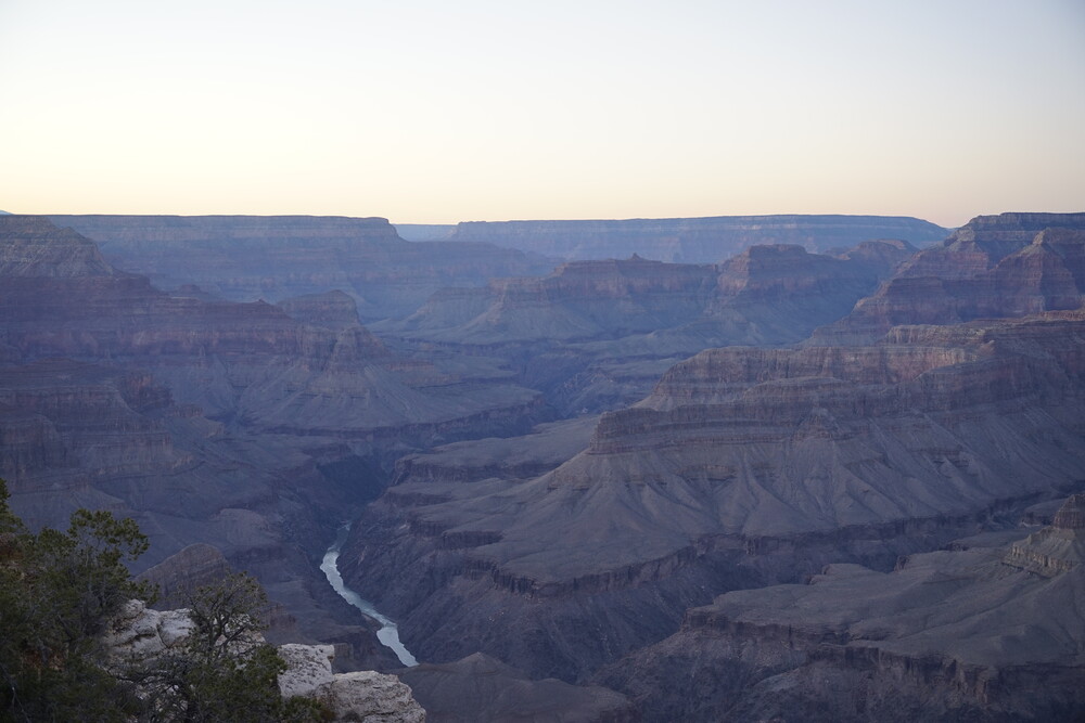
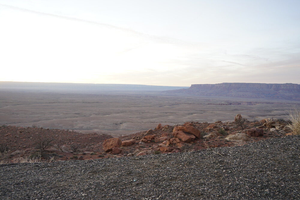
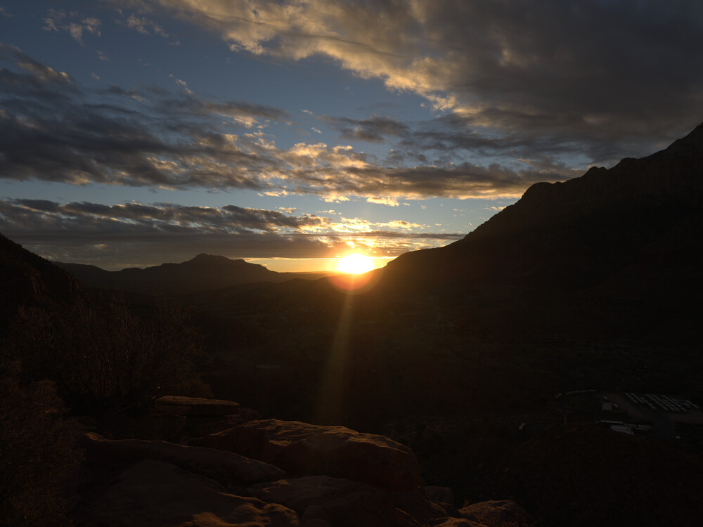
On the first full day over at Beatty, of course had to head to Death Valley. The drive into the park included a long straight stretch of road. I did see this road the day before on my way to Rhyolite, but it’s even better during daylight. After an elevation change up, it’s all downhill from there, to the point I was using more brakes than gas, and if I didn’t break I would have accelerated probably to 88mph. Below is a spectacular view of the valley at a stopping point.

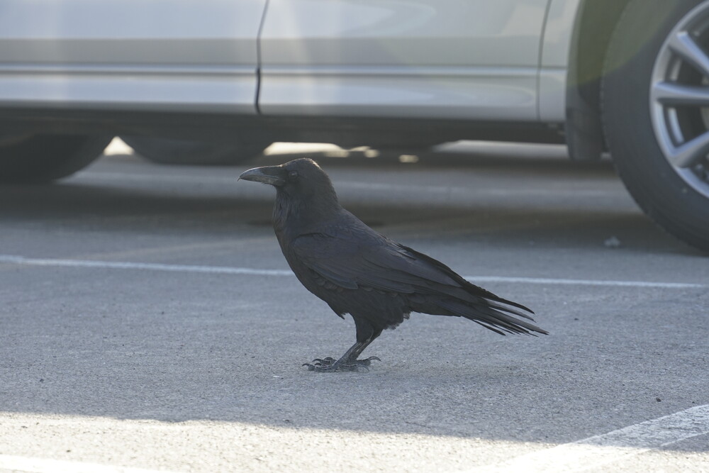
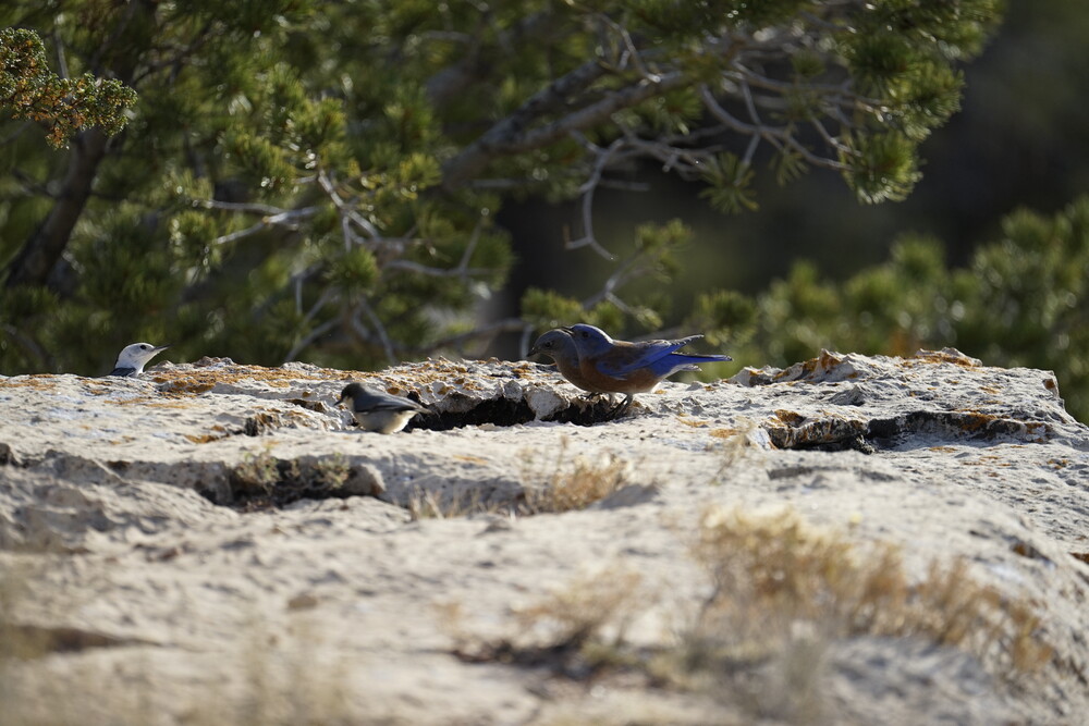
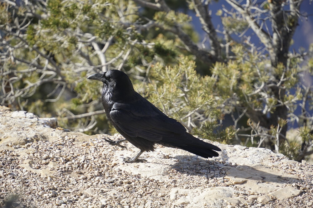
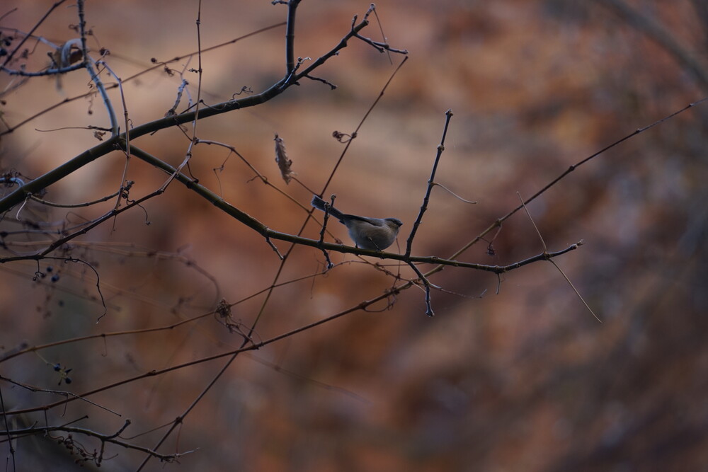
At the stopping point there was a kiosk to get a day pass, which was broken. Because I needed a pass, I headed right to the park’s visitor center. There I got the American is Beautiful pass. Because I was planning on visiting 4 national parks in the span of 2 weeks, so it immediately would pay itself off. There was also this nice bird outside

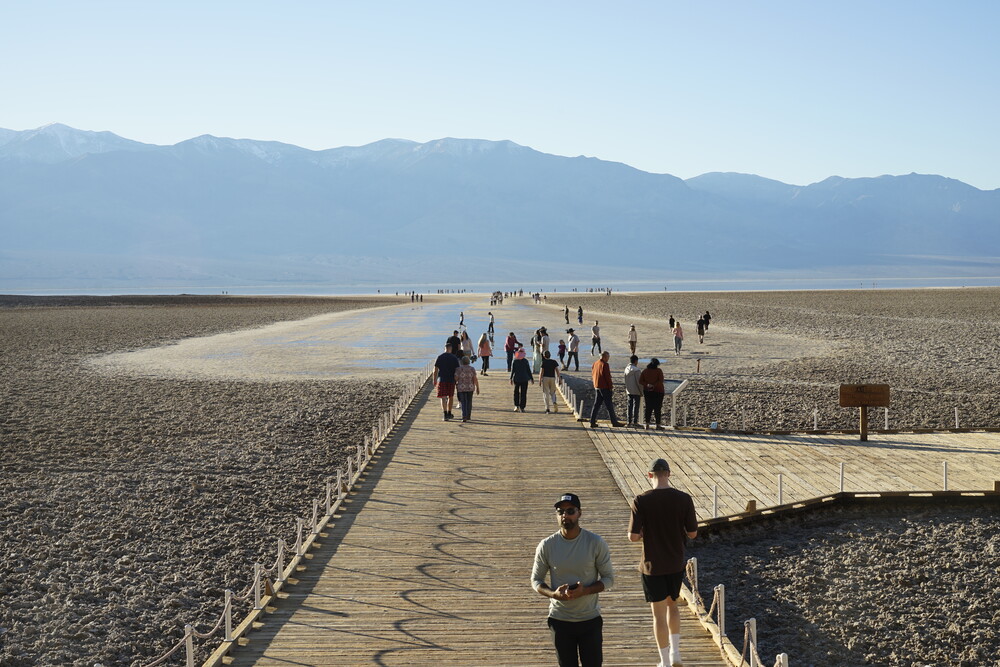
I headed to Badwater Basin. Supposedly according to the park’s webpage it was closed at the time due to recent floods, but the road was open with others driving through when I came up at the intersection. I probably lucked out when they decided to open. As I arrived at the basin, the parking situation wasn’t great, and by that I mean I couldn’t find a spot. This was mid-day but in November, I can’t imagine how bad it gets during peak season. I decided to drive back and try a trail around, hopefully when I come back the parking situation would be better. I decided to go up the Natural Bridge trail. The road up to the trailhead, well I wouldn’t consider it a road. A very bumpy ride. The park did not mark it on their map as a 4x4-only road, so I think most cars should be fine? The trail itself was nice

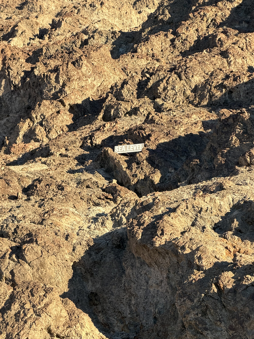
After I decided to drive back to Badwater. While the parking was still full, I was able to luckily find a spot. Walking on the basin was cool, and seeing the salt deposits was also neat. I did not try to walk in the water like others, I’m sure they were quite salty. The basin is ~282ft below sea level, and there was a sign on the mountain to indicate it. It’s surreal to think that, if the basic was on the ocean edge, that it would all be filled where we all stood.
On the drive back, it was approaching sunset. For some reason, I decided it would be a great time to go on a “quick” trail walk to the Red Cathedral. Turns out this wasn’t a “quick” walk, and I vastly underestimated the trail length. I did make it at the cathedral, but by that time I think it already approached sunset. On the way back I was half-walking half-sprinting, as I was quickly loosing light. I was quite terrified, amplified by the fact I was the only human on that trail on the way back. I also heard several bats fly above me. It’s my first time hearing a bat in the wild. By the time I made it back to my vehicle, it was almost pitch black. Probably shouldn’t have done that trail walk that late.
.jpg)
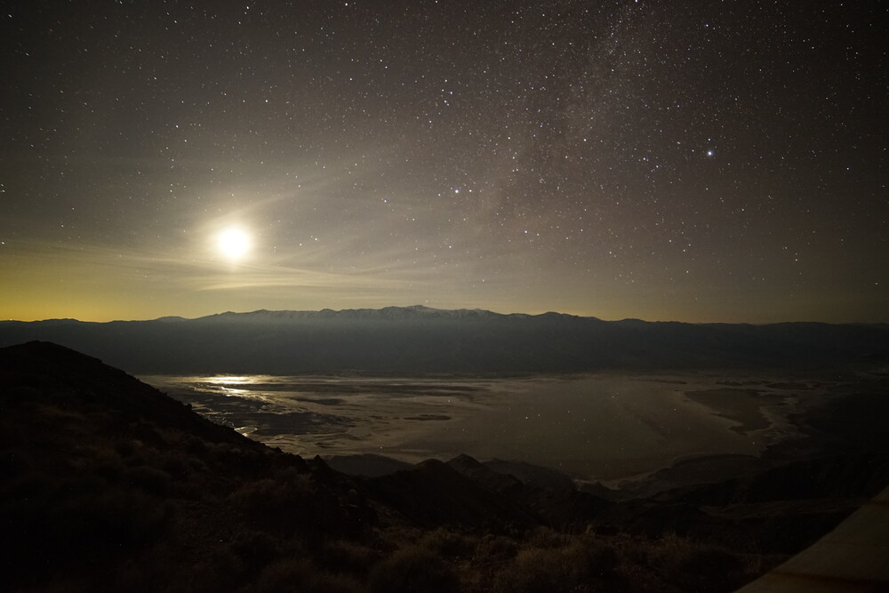
After that fiasco, I was debating if I should stay at the parking lot I was at to do some astrophotography, or go to Mesquite Flat Sand Dunes. As I was by myself in that empty parking lot, I decided on the latter. I’ve heard Mesquite was a popular spot for astrophotography. A 40min night drive later, I was retrieved to find other people there.
There I took a lot of dark sky photography. I think those were my best ones yet as far. It was also a new moon, which was the perfect scenario. Even with my own eyes I never saw that many stars beforehand. Truly a moment I still cherish. By comparison we scammed here in the North East for our night sky.
.jpg)
-C.jpg)
The sky was so dark, that even some 200miles away from Vegas its light pollution was effecting the south east side of the sky on the horizon. I could even notice it with my naked eye.
.jpg)
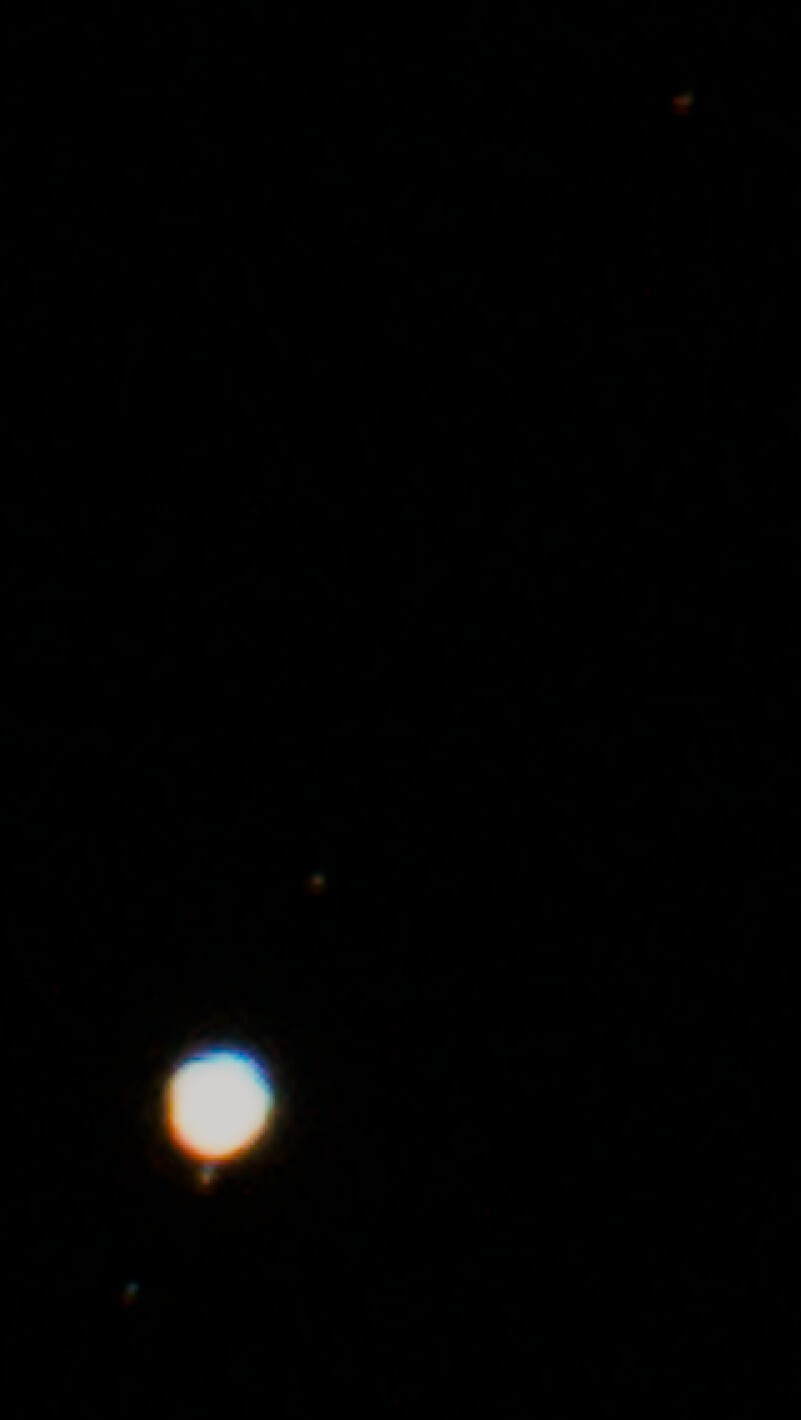
While taking some pictures I noticed a bright dot come up on the sky. Looking at my phone’s night sky app, it was Jupiter! Zooming in as much as I could with my 500mm lens, I could barely see a dot on my viewfinder. Writing this later, in post I could see not only the planet, but what I believe to be Jupiter’s larger moons. There isn’t a lot of detail in the image, only a few pixels, but cool that I captured it nevertheless.
Even during the drive back to the hotel, I couldn’t help myself stopping once in a while and opening the window to ponder the night sky.
Day 4 - More Death Valley
Waking up for the second day for Death Valley, I decided to have breakfast at the nearby Gema’s Cafe. Neat little breakfast place, if I remember correctly I got myself an omlet and a smoothie.
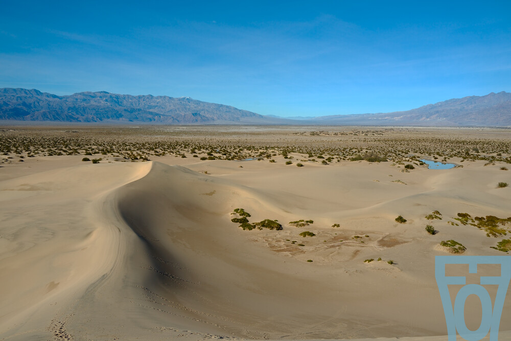
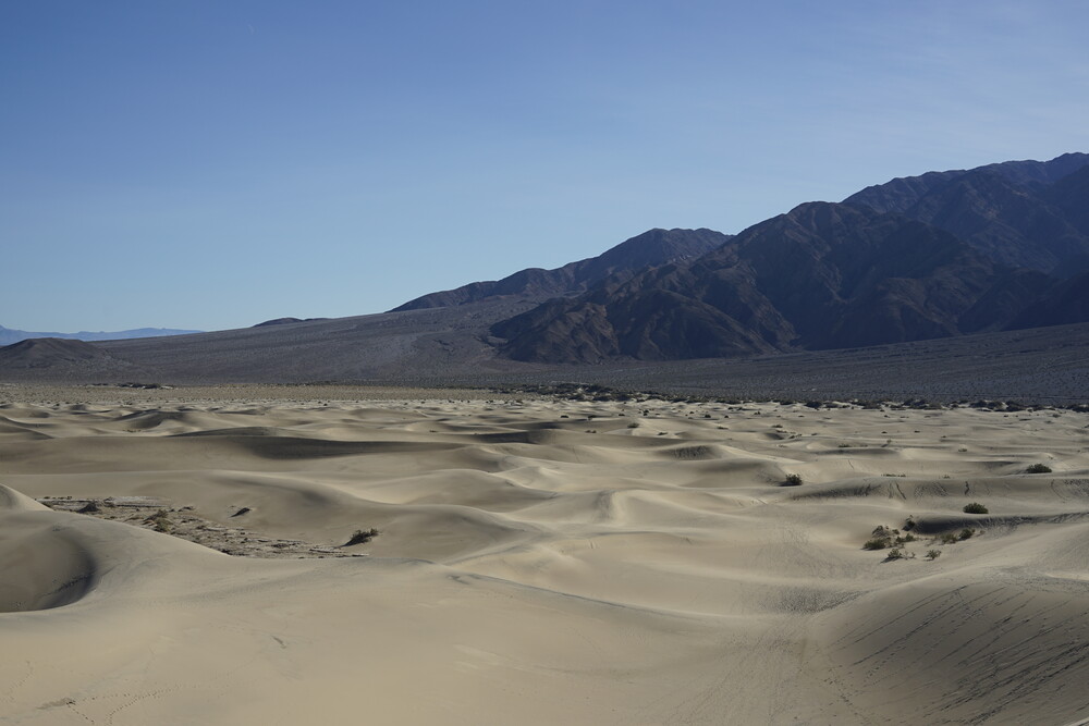
My first itinerary was to head back to Mesquite Dunes to see it in daylight. Last night was the first time I was there, so I had only gotten a night’s view of the place. Even driving to it, it looked strange in contrast to the landscape around it. It was just an area of sand, surrounded by rocks. Quite strange.
Up close the dunes gives the feeling of being in a stereotypical sand desert. Without looking around the rest of the basin, one could easily mistake the place for some other desert in the Sahara. Walking on the sand was exhausting, more than one might think. I did make it to a sand-dune peak. The view was amazing from up there.
After that bit, I drove to the nearby station/town of Stovepipe Wells and drove beyond on the stretch of road. The road looked short on Google Maps when I was planning this trip, turns out it is much longer than I expected.
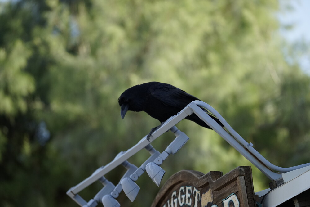
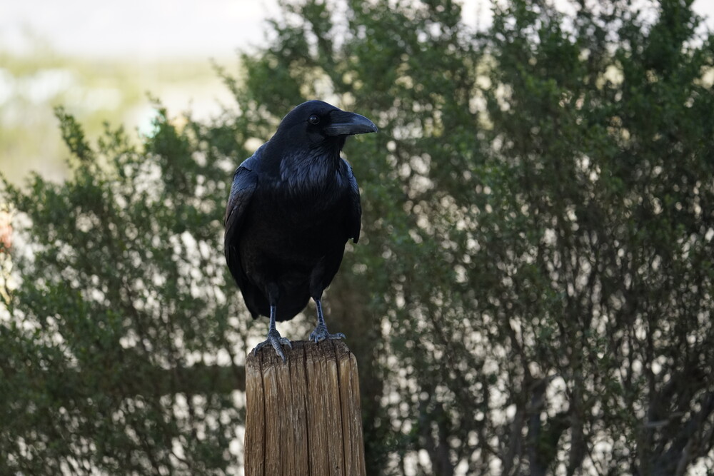
So after 5 minutes of driving I U-turned back into Stovepipe Wells. There I stopped to use the restroom, get myself a drink and a sandwich. In that parking lot I saw some ravens, lovely creatures. Bigger than I expected though.
After that, it was around 2:30pm. I knew I wanted to see the sunset at Dantes View, and given the drive and that sunset was a 4:30, I immediately headed out.
I did stop by at Harmony Borax Works along the way, and rushed it as I was really pushing it in time. Slaves Chinese laborers were apparently used to mine borax, and were hauled by a 20-mule team.
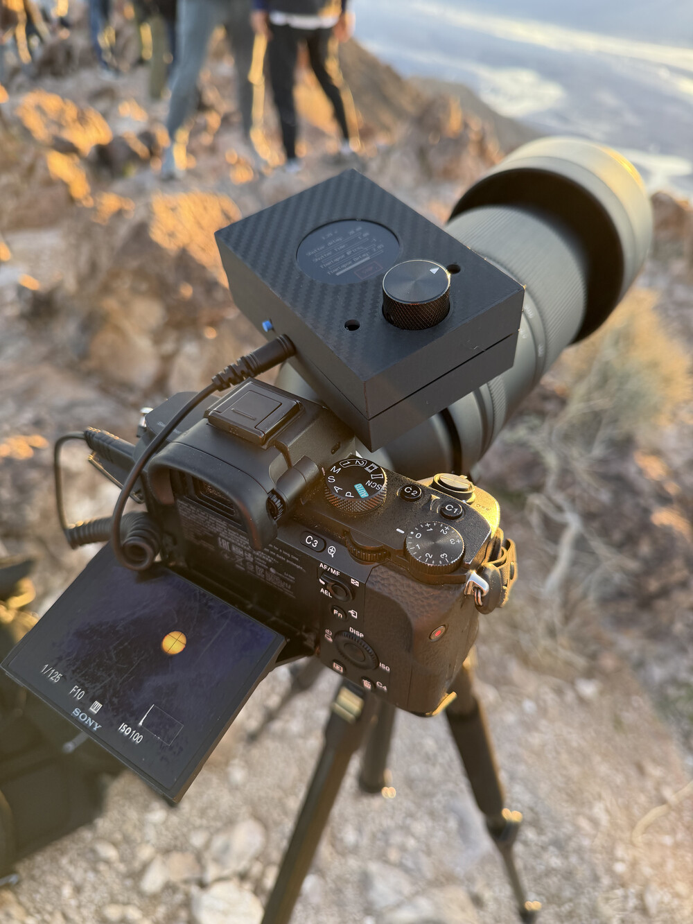
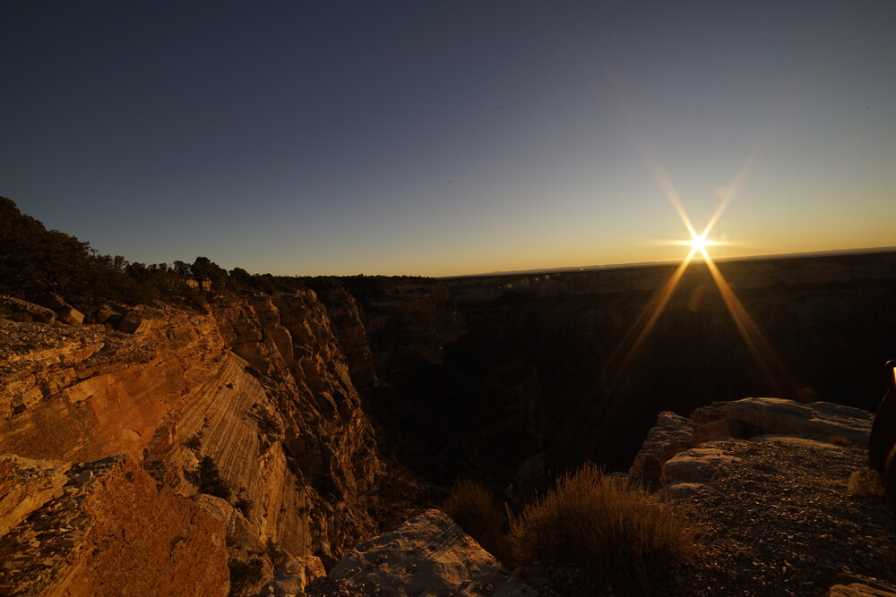
Thankfully I barely made it for sunset at Dantes (actually I had 15-20min, but felt close). I climbed the peak and setup my camera gear with my tripod. This would also be the first time I actually used my camera shutter I designed in “the real world”. It worked without crapping out! I call that a win. To take pictures of the sun, I had to use an ND filter I had with me. That filter I actually bough in 2024 for the solar eclipse, which all I got to see was clouds. Well thankfully there is was a good use for it now.
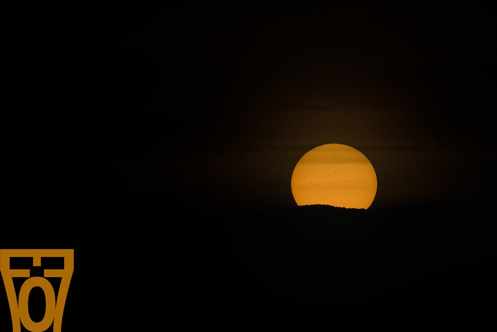
During the sunset, the mountains behind me started to turn into this wonderful shade of pink. It was overall a lovely view.
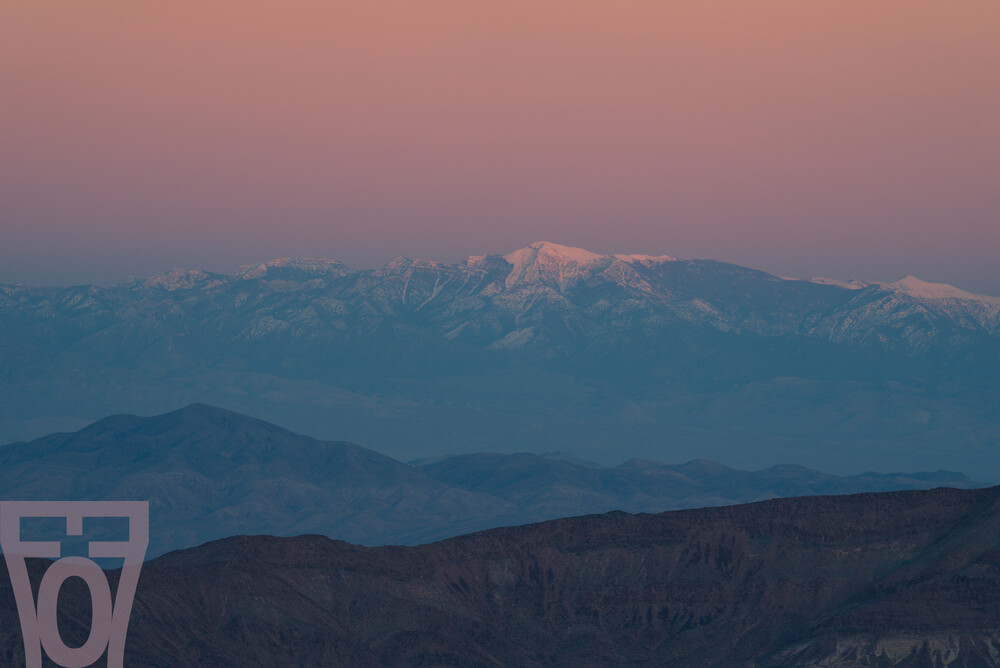
After the view, I went down to the parking lot where I stayed for more astrophotography. This day the moon also came up earlier as the lunar month was under way, so later on the night the moon created more sky light. It did give for an interesting look.

Day 5 - Drive to Grand Canyon and Hoover Dam
On the next day, I packed up in the morning, said goodbye to Beatty, and started my drive to my next destination: Valle, AZ. Yeah it was quite a drive.
As I was driving through Vegas, I stopped by Costco for gas. The parking lot was quite full. I also accidentally filled the car with premium gas like an idiot. I must have mis-clicked with the gas tube. Did it feel premium? Did my car turn into a horsepower beast? No, it just was regular gas with an increased price tag. I also stopped by an In-And-Out for another wonderful burger; I do have to take advantage while I was there.
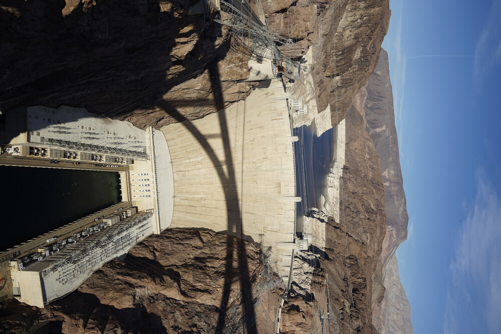
Continuing on I-11, I noticed this neat highway stopping point to overlook Lake Mead. Really big lake.

Of course I had to stop by Hoover Dam. The first stop was to walk on the I-11 bridge. Apparently the bridge wasn’t built and finished until like 2015, beforehand one had to go on Hoover Dam to cross from Nevada to Arizona. There is also no other option nearby except for a long drive south. Must have been miserable times. The dam itself was cool to see for a first time. Huge. And it was built in the 1930’s! Amazing feat of civil engineering.
After the walk on the bridge, I crossed the dam and parked to walk to the dam’s visitor center. There were some paid parking, but slightly further along (and by that I mean no more than 500ft) there was free parking. My guess is during the summer time the free parking gets instantly full, requiring the paid parking. Walking on the damn there were two intake towers, each with a clock offset by an hour as walking on the dam crosses a timezone. That’s one way to borrow an hour quickly.
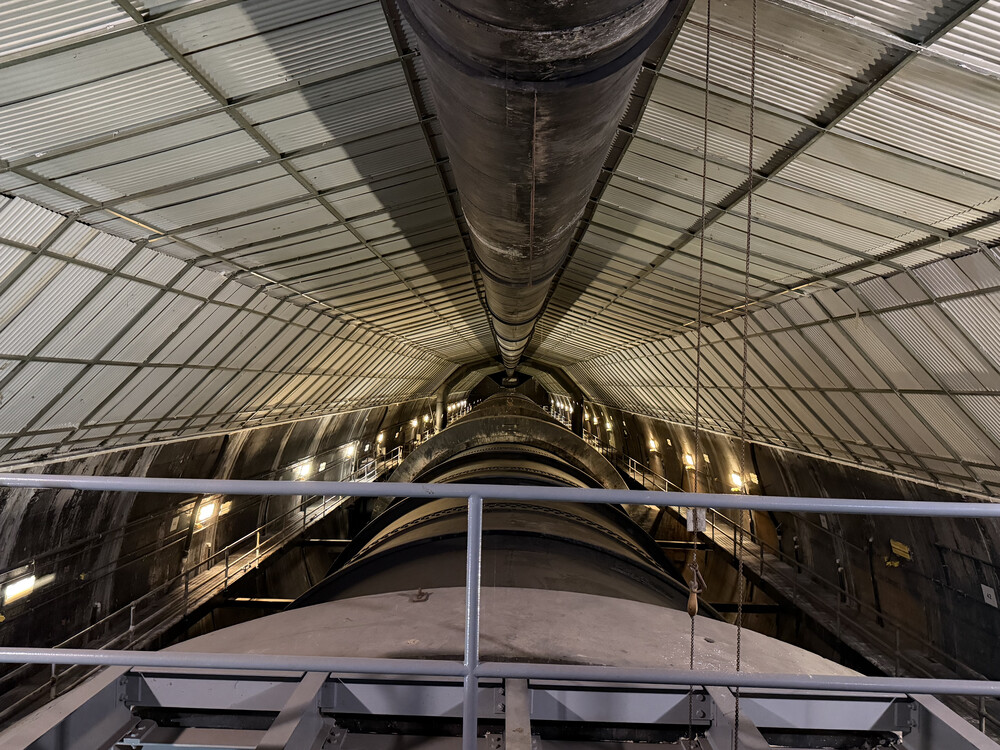
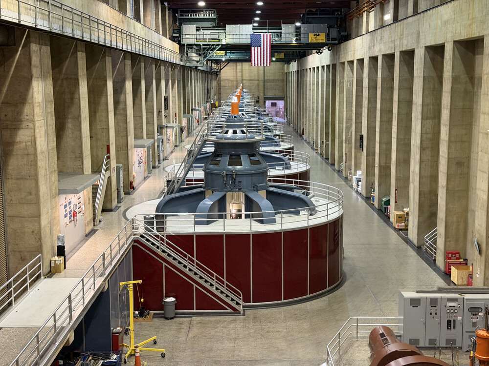
In visitor center tour, they took us several floors down to have a look at the dam piping that carries the lake water out of the generators. Massive pipes, it was sort of hard to get a sense of scale. They also took us to see the generators. They were huge, which makes sense for the scale of the dam, but cool to see. Only 1 or 2 generators were actually active at the time, I was told it’s partially because the dam was near an all-time low water level, and electricity demand wasn’t high at that time. I cannot iterate how it may seem “easy” to build a system with modern tech/planning/simulations, but this was the 30’s! I’m sure every parameter was hand-calculated, given digital calculators weren’t a thing yet.
After all that, I took the long drive (4 hours) from the Dam to my next hotel. At that point the sun already was set, so I was mostly driving at night. Nothing interesting along the way, except for what I could guess was a solar or wind farm with red LED illuminators that blinked once every 10 seconds or so. It looked like something out of sci-fi at night. On the drive to the hotel I did stop by McDonald’s in Williams, AZ for some food to go, and drove up to the hotel which was 30 minutes away. There I almost hit a deer, thankfully I was aware and was able to slow down and move out of the way. Something that also stuck me was I was expecting a desert, but on the drive, while at night, it looked like a forest. I didn’t do enough research ahead of time, but that whole area is close to a National Forest. I was not expecting that.
The hotel I was going to stay at was the Grand Canyon Tiny Home Rentals. A neat idea where essentially mobile homes are converted to a “hotel”. After driving on Route 180 for a while I reached the “road” to turn to get there. I put road in quotes because it was just a dirt path, so calling it road might be an overstatement. I did hear about this in one of the reviews for the hotel, so I wasn’t expecting much. It wasn’t as bad a that review made it out to be. Yes it was bumpy, but at a decent rate of 10-15mph, it wasn’t car destroying bumpy. I’ve been on much worse potholes here in the Northeast. The hotel itself was lovely. They send you a door code over email to unlock, and that was the only “interaction” with the staff. I sort of like it, beats waiting in line on arrival, especially how late I was arriving (like 10-11pm). The room itself was ok, nothing special, but I am not that demanding. The heat/AC unit was strange to figure out at first, it didn’t heat as fast as I wanted, but once I got the hang of it and let it heat up the room overnight the temperature stabilized to an acceptable level.
Day 6 - Grand Canyon
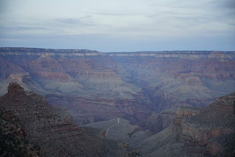
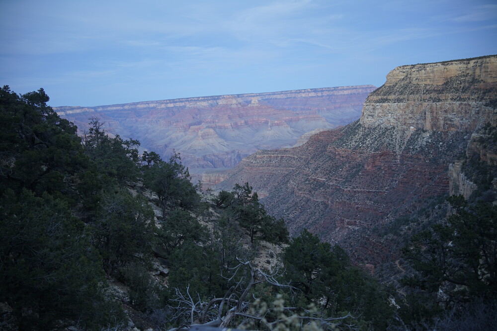
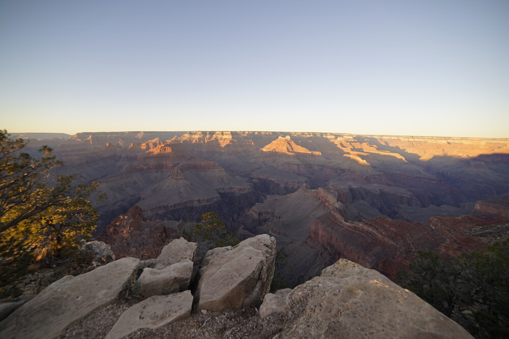
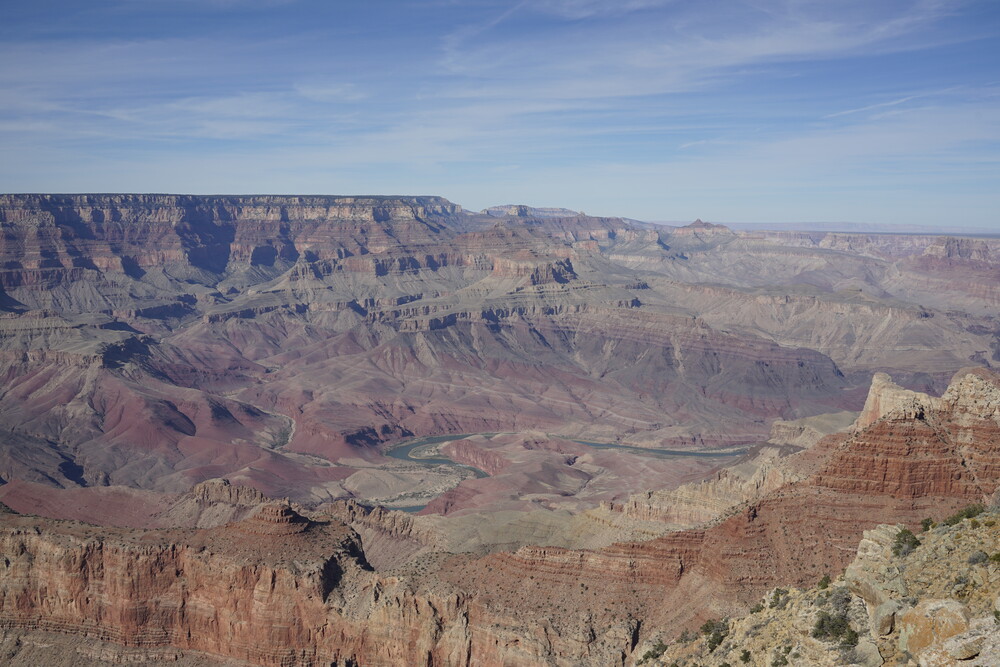
First morning in Arizona, I drove right down to the Grand Canyon. The toll booth wasn’t bad of a wait, only like 5 minutes, but it did get a bit worse up to 20min for the following day (a bit for foreshadowing). I drove and parked in the big visitor lot, and walked to Mather Point. Yes it’s THE touristy spot, and it was more packed that other locations, but it was still a lovely view of the canyon. At the time of year (thanksgiving day) I was in it also wasn’t miserably packed.
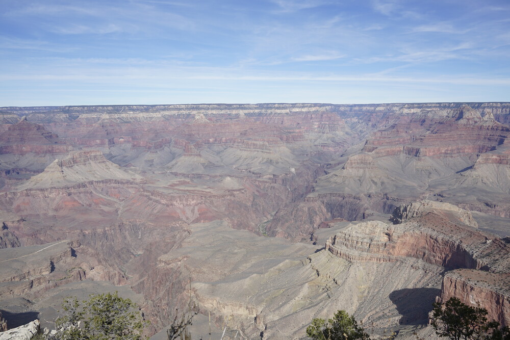
So the thing about my first view of the canyon, I wasn’t as impressed as I would be (at least the wow factor). Don’t get me wrong, it is still amazing and I would visit again, but he thing is it’s very deceiving in scale. Like you know it’s a very large canyon, miles across, but it doesn’t come across that way. It’s like humans trying to understand what a quintillion is. The colors also weren’t as vibrant as pictures made it out to be. Later on I figured out (through a reflectoscope demo in the Desert View visitor center later on) that it’s the brightness of the canyon that makes the colors sort of washed out, desaturated. The rocks were still colorful, but not to the point pictures make it out to be.
After that I walked along the Rim Trail through the “Trail of Time”. It’s a really cool thing the park did, where along the trail each step is initially an exponentially growing length of time, until at some point where it just becomes a million year increments, and you are to walk for 2 billion years through the past. Along the way there were informatory signs on the canyon’s history on it’s formation and geology in general. Later on the the 100+ million years mark there were some sample rocks from the canyon formed in different eras to feel. Some were really cool and smooth, some had near textures, others looked like regular rocks.
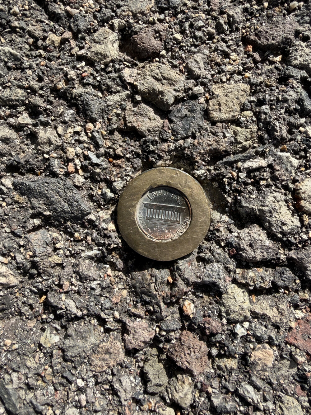
Something that was intresting is the floor markers were actually pennies stuck to the ground. Probably the few good uses for that denomination.
At the end of the trial, I reached what seemed like another main visitor center. It was actually the main village of Grand Canyon. I decided to climb down Angel’s Trail. The warning signs made it clear that doing the entire thing was basically impossible for when I reached the trail late in the evening, on top of being very difficult normally anyways, so I stuck to only go down to Arch #2. It’s fascinating how the view of the canyon changes as one goes down in elevation. Even at Arch #2 there was a lot more down to go. The way down was the easy part, the way up…well the park does let you know it will be twice as hard. Arriving back at the top, I waited at the bus stop nearby to take me to the main visitor center. Thankfully I arrived when I did, because no more than 5 minutes later a bunch of people off an adjacent bus stop (from the red line) started queuing back up to go to the main parking like I was.
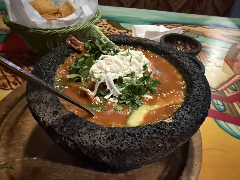
After all that, I had dinner at Plaza Bonita Restaurant. They had some volcano rock bowl dish thing, and I took that with steak if I recall correctly. The steak/chicken had more fat that I would like, but otherwise the thing was delicious, and boiling hot. I got too full, felt like a sloth afterwards driving back to the hotel.
Day 7 - More Grand Canyon
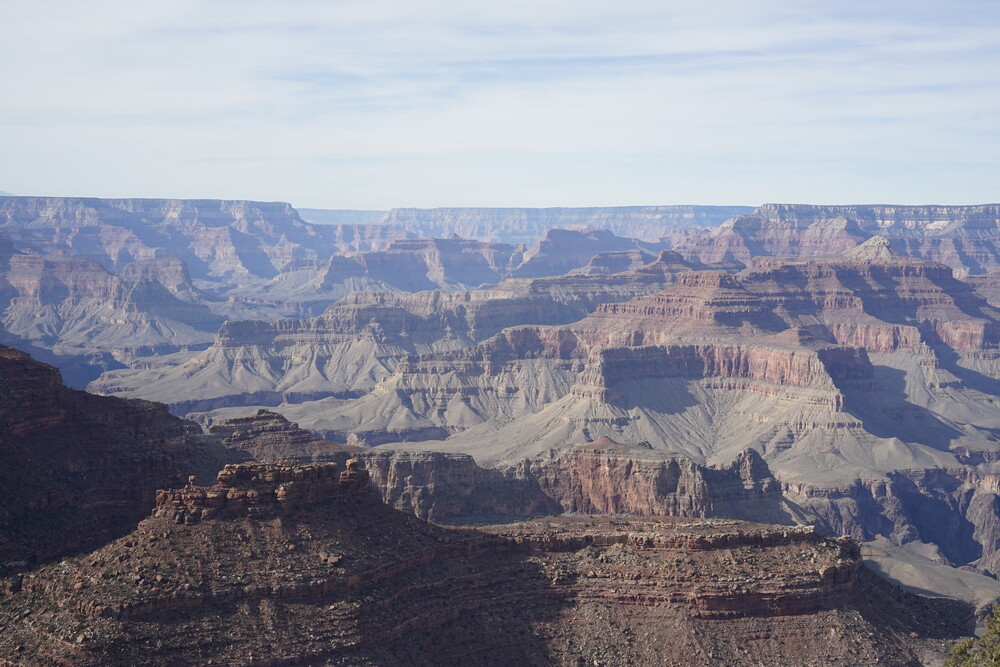
On the next day, per my previous indication, the wait at the toll booth was a lot longer than the last day, like 20min. Passing that, I knew I wanted to take a bus heading to the western side of the canyon. I initially parked near the main village, wanted to take the red line bus. After my indecisiveness, even as I arrived at the bus stop, I decided instead to go back to my car and drive back to the main visitor center to rent a bike. I was hoping I could rent a bike to go on that side of the park. When I arrived at the bike rental shop, I was told they only have 1-hour rentals left. While it wouldn’t be enough to take me to the trail I wanted, it was enough to take me Yaki Point and back I was told. So I did it. If it’s one thing I learned from that 1-hour bike rental, it is I am really out of shape. It was exhausting to bike along, and had to make many stops. Of course I did stop at some points in between for the view, which also served as an excuse to stop. Along the way the chain also came off, but that was an easy in-field repair. Yaki Point was neat. It’s a different perspective on the park.


The bike ride back was a little easier, as it was more on a down-slope.
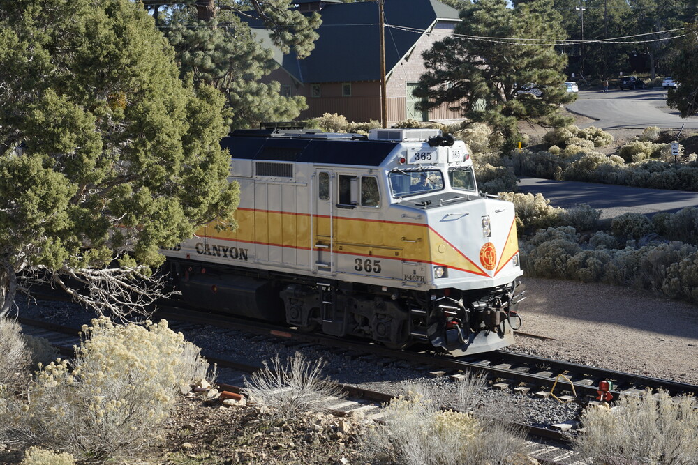
After returning the bike, instead of driving back to the main village, I decided to take the Blue bus there. Other than “I wanted to”, I also had to be back there later on the day as you will read about soon. The wait for the bus wasn’t too bad, longer than if I were to drive, but not too bad. After arriving near the transfer terminal on the village, I actually hopped off a little earlier to get a view of the Grand Village Train leaving back to Williams.
At the main village I I did get myself some hot chocolate and a Snicker bar. I also took a quick visit to Kolb Studio, which was a really nice art gallery of everything Canyon related.
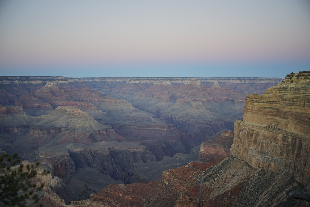
After waiting a bit, I took the red bus to Hopi Point, and walked along the trail to Mohave Point. Like Yaki Point, this was another entirely different view on the canyon. From here I could also see part of the Colorado river flowing by. It looks so tiny from up at the rim, but I am sure it is wider than a highway. At Hohave Point I stayed around for the sunset. It was a wonderful sunset. The park behind also changed colors as the sun went down turning more yellow and pink-ish.
A bit after sunset, I went and waited for the bus. Thankfully I did not stay too much later, as that bus was packed, presumably from everybody else waiting for the sunset. Back at the visitor center, the bus situation did not get better, with everybody from the Red line wanting to on the Blue line for the parking lot. It was a decent wait, but eventually got on the bus. At one point I was contemplating just walking to the visitor center, but that would be an hour ordeal I did not feel like going through.
After arriving back at the visitor center, I stuck around a bit until 7pm, where astronomer Dr. Daniel Fleisch was scheduled to give a talk on the stars. He was setup with a telescope, an camera that integrated over several seconds with some neat software, a projector to show us the camera output, and a laser to point to the sky. It was a neat talk, would 100% recommend if you are in the area if another talk is scheduled. He went over the different constellations in the sky and their greek history. To be honest I don’t remember a lot of it now, but it was still a neat talk. It was cold outside, I was freezing, but worth it to stay the whole time, even in the “after show” where he pointed the telescope in different parts of the sky to capture.
Day 8 - More Grand Canyon, and drive to Bryce Canyon
This was the day where I made another long drive from Grand Canyon to Bryce Canyon. I planned so along the way I would still drive through Grand Canyon Park, stopping among different view points on the way.
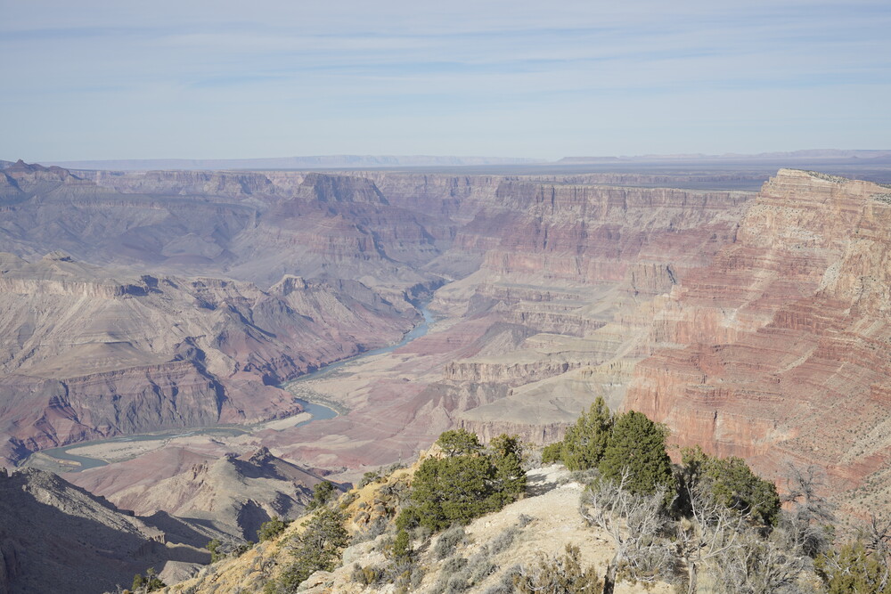
Each new stop was a different view of the canyon. As I got closer to Desert View Watchtower, I was able to see more and more of the Colorado River in it’s blue glow. Arriving at the watchtower, it was a neat building and area. The whole area offered the best view of the Colorado River as it came from the North and moved along west. I had to get a time slot to up the Watchtower itself, but the wait wasn’t too bad. In the meanwhile, I explored around. Apparently there was a flight crash “nearby” (in relative terms) in the 40’s or 50’s where two planes collided with one another, with no survivors. That was a sad read.
Apparently the watchtower was built with purposeful imperfections in the brick placement for an artistic style. I like it.
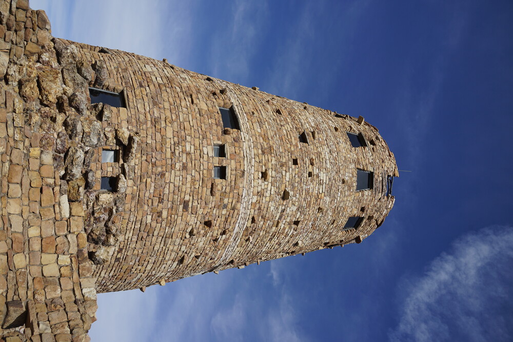
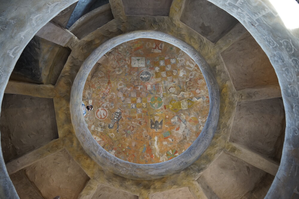
Once my timeslot arrived, I went up the watchtower. The view out of it was amazing, similar to the outlook nearby, but higher. One can even see a mountain nearby which I forgot what was called. The tower also had some painted artifacts of the indiginous people as a work of art.
After that I started the long drive to Bryce Canyon. I stopped by for gas at Conoco in Cameron, Arizona. In the gas station there was a poster for a shoplifter with a warning sign that they are not allowed on the premise. I wonder how active policing is around these parts.
On the drive to Bryce, the mountain views to the side were amazing. Around when I was driving the sun was coming down, so I got to enjoy a view of the mountains and canyon off a highway stop with a sunset-like view.
I did stop by New York Teriyaki in Page, AZ for dinner. Really good suchi. I also stopped by the nearby Walmart for some snacks.
Finally arriving at the hotel in Bryce Canyon late at night (again), Best Western Plus Ruby’s Inn, I went off to sleep. Don’t have much to say on the hotel, it had a neat wodden-like style to it. It also had a gift shop and a buffet integrated. The buffet was part of the breakfast that was complimentary.
Day 9 - Bryce Canyon
Waking up, I had breakfast at the buffet. It wasn’t the most amazing of foods, but it was free, who am I to complain. And it was a buffet.
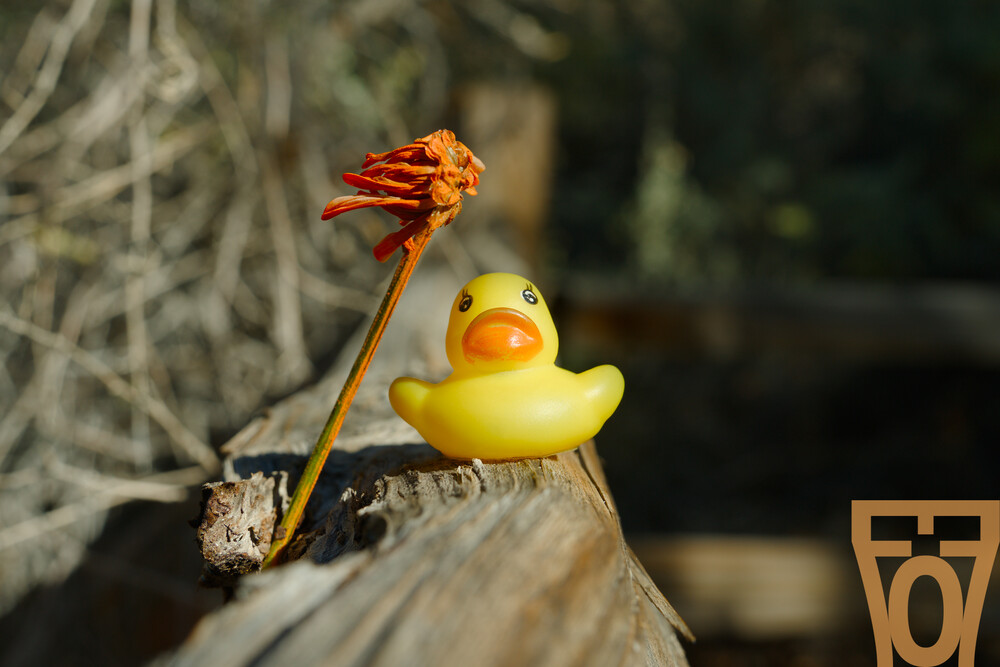
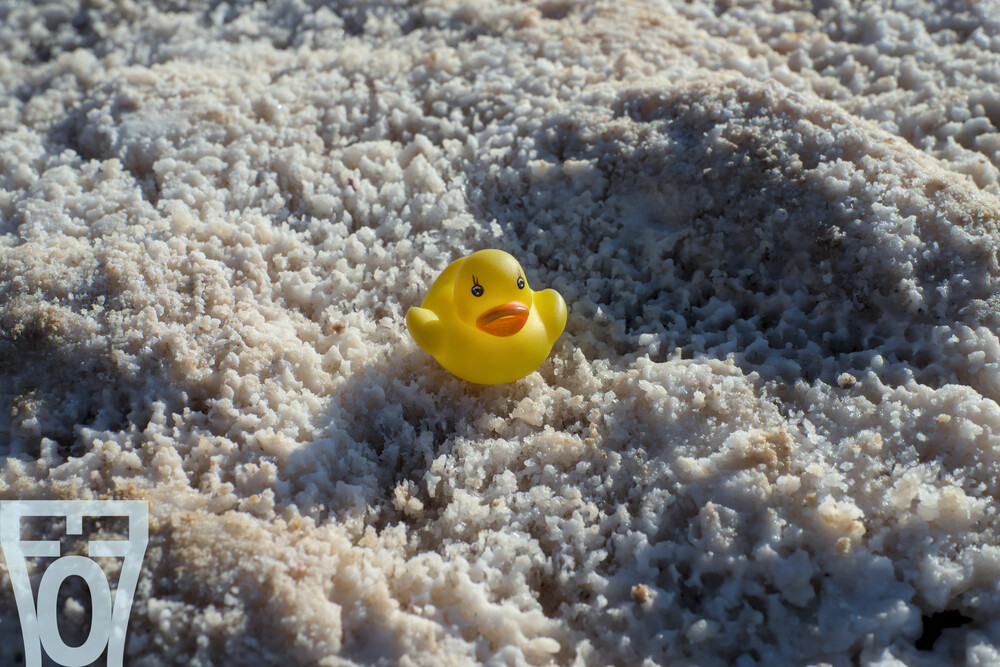
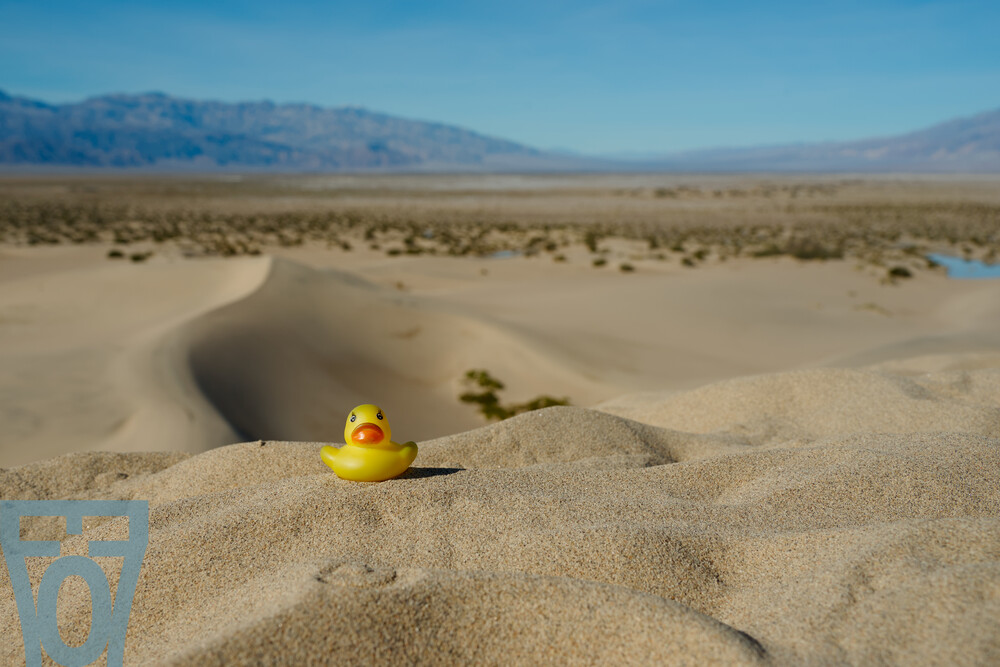
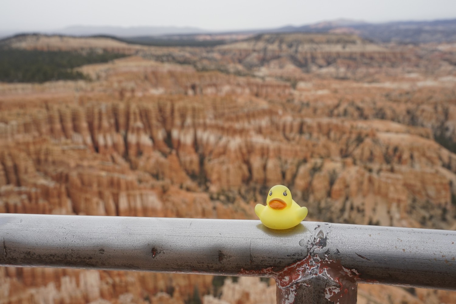
I went and drove along Bryce Canyon. It snowed a couple of days beforehand, as the “towers” in the canyon were covered in snow. It was also sort of windy. I almost lost Duck to the Canyon, as I positioned it on the guardrail for a picture, if it wasn’t for some grass. I was able to quickly go on the other side around, holding on to the rail, to fetch it. That was a close call. From then on I was really conservative where I placed the Duck.
Driving up the canyon was cool, I did stop by different stops for the views. As I drove up it started snowing a bit, not enough to stick on the ground, but enough to be visible. It was also getting windier and colder. I did make it up to Rainbow Point. Around this point it was getting really cold, so I called it a day and started heading down. I did stop by one or two places on the way down. While I didn’t enjoy as much time as I would have liked at the park, it was still enjoyable with nice views.
There was a point dedicated to Piracy, but I did not accounter any pirates. (yes this is a joke, laugh)

Retuning to the hotel I decided to do laundry, and stop by for the buffet dinner. I remembered the buffet costing a bit more than I would like, but I could not be arsed to drive elsewhere for food. The food was mediocre, sort of expected for a buffet.
Day 10 - Drive to Zion
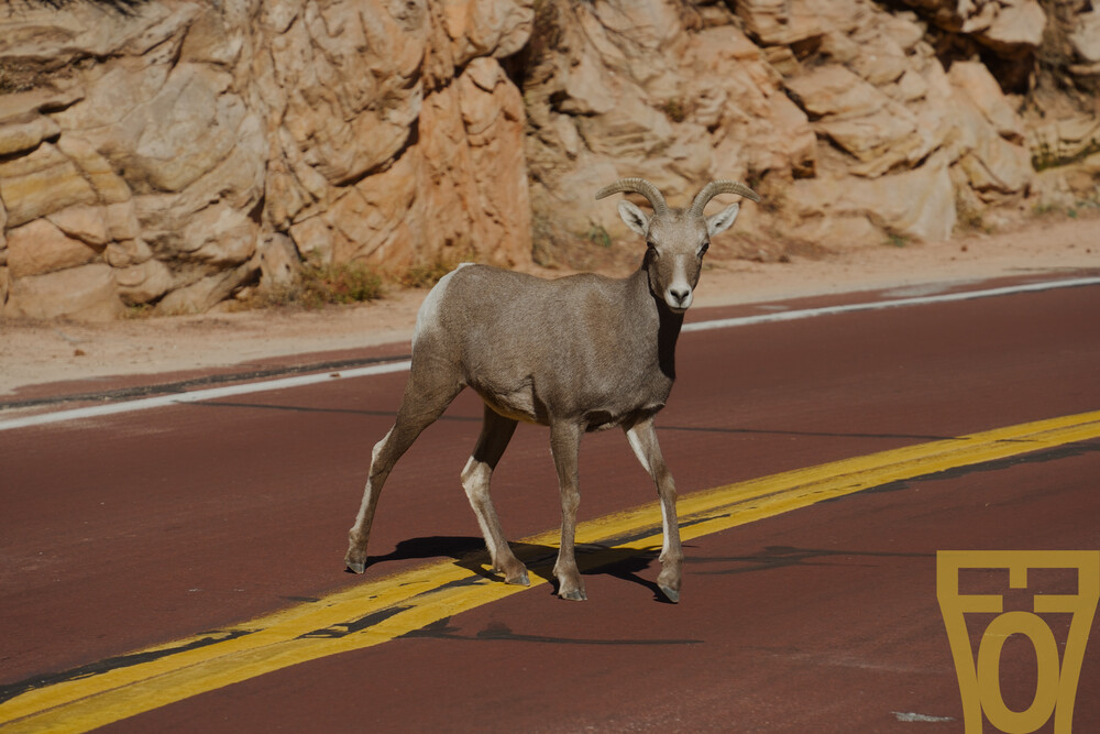
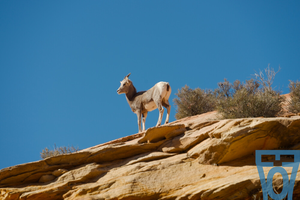
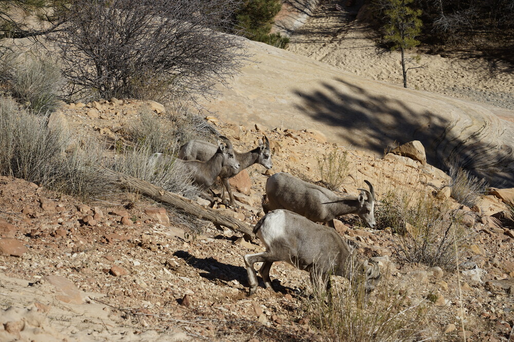
The next day, after another breakfast round, I started driving to Zion National Park. As I drove along more to Zion, the snow on the ground from the previous day disappeared. Turns out only around Bryce Canyon was it snowing, which makes sense as it was at a higher elevation. Zion only got to see some rain. It was getting sunnier as I approached the park. After the long drive, arriving on the premises of the park, it was a lovely mountainous drive alongside Mount Carmel Hwy. On the drive I stumbled upon some bighorn sheep, which I had to pull aside in a road stop and take some pictures of.
Along the drive I made a few more stops to take pictures and gaw at the view. There was a tunnel along the way, which is normally two ways, but for that duration was one-way. I think some bus was passing along, which they shut the tunnel until it passes as it is a narrow tunnel. After the tunnel, I reached the canyon junction, with one path leading me to the normal road and hotel, and the other leading me into the Zion Scenic Drive, which is where the “true park” is at where people come to, and where most of the trails are at. Here is a map for reference. I decided to go to the park before I check in my hotel, as that can be done long after sunset. It was December, so the road was open to the public. During other times of the year, only park busses are allowed into the road, due to the crowdedness of the park in peak season.
On the drive along the Scenic Road, near the Zion Lodge there was a backup of cars going up. It seemed like the park limited the number of cars after that point, presumably to reduce on contestation. That was a 20minute wait or so, although it wasn’t as bad as far as I remember.
I drove all the way to the last parking lot, Temple of Sinawava, barely finding a spot to park (even on Dec 1st), and walked along the Riverside Walk trail. It was a lovely walk, the sound of the river always there in the background. I also came cross these super tiny birds chirping in a tree, which I have never seen birds this small. My heart was melting.
Reaching the end of the river, I noticed some people went beyond the Riverside trail. The trail does become The Narrows trail, but this requires to cross the river, and it can be dangerous due to sudden flash floods. As I was not wearing waterproof shoes, this was a no-go for me.
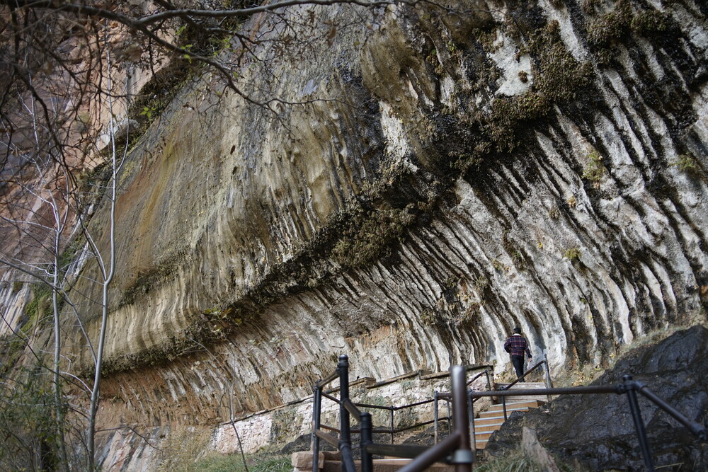
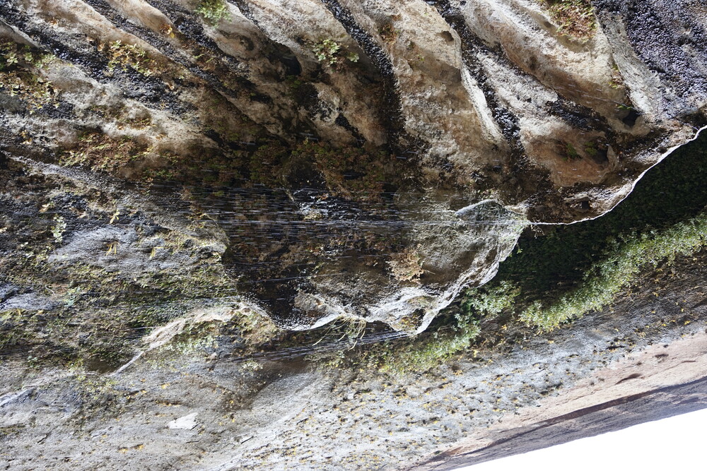
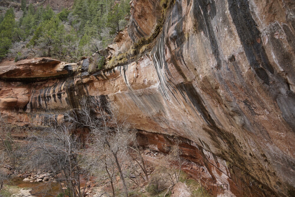
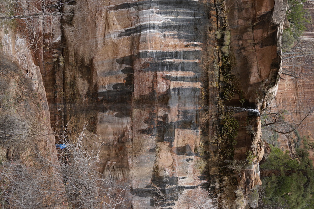
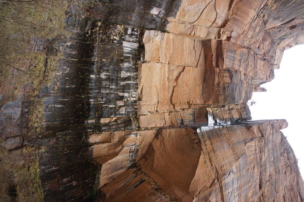
Walking back and reaching my car, on the drive down to the hotel, I did stop by two other stops on the Sceneric drive as light was still out, which included Big Bend and Weeping Rock. Big Bend wasn’t as special, but Weeping Rock was interesting. It is a cliff where upstream water falls from, but not enough to create a full waterfall, so droplets fall from the rock above. As this happened for probably hundreds of years, the rock forms mold and discoloration where water preferred to flow, creating a view that looks like the rocks was crying (thus the name).
After that I drove down to the hotel as it was getting past sunset. The hotel, Zion Canyon Lodge, was nice, the front receptionist was nice and seemed to care. The location was also walkable to many nearby eateries. That night I walked to have dinner at Zion Pizza & Noodle Co. It was wonderful pizza, albeit a bit on the expensive side, but I expected that for this area. This was also the last night the restaurant operated for the 2025 season, so that was unexpected lucky timing on my part.
Day 11 - More Zion
The next day, I skipped on breakfast and had tea from the hotel lobby. I drove back up to the Scenic road. This time I stopped at the Zion Lodge trail parking, and started to make my way on the Lower Emerald Trail. It was a lovely walk. Alongside the trail looking to the right one can see the rest of the park and the mountains around (when not obstructed by trees), which was a lovely view. The mountains also were gradient in rock color, presumably due to the billion years of erosion through different periods, similar to the Grand Canyon.
There was this neat waterfall like area, similar to Weeping Rock, but only 1 water stream.
At an intersection point of the trail, I decided to go up the Upper Emerald Trail. This wasn’t as easy compare to the Lower trail, mainly due to the steeper elevation changes. Reaching the end of the trail, there was a small waterfall like area, sort of concaved in the mountain. It felt like it’s own little area.
Walking back, I headed back to the lot, this time through the Middle Emerald Trail. It was better than the Lower Trail to get a better view of the park, as it was more elevated.
Reaching back to the car, I tried to head east through the tunnel to see if I can trail the Canyon Overlook Trail. Unfortunately the parking for that one was filled. It didn’t help that only like 5 cars could park. There was another parking near the entrance of the east tunnel, but that was a one-way entry into the lot. So I went back-and-forth through the tunnel 2 times; the first not knowing the parking lot had a uni-directional entrance and my first time driving to the trail, and the second time trying to see if I can find a spot. I was unsuccessful, so I called it a loss. Instead, I headed down to the Visitor Center to have a look. It is a nice center to walk through, with the inside of course including a gift shop, but also information on the park and trails. The building also was, according to an information bulletin, designed to naturally capture sunlight during the winter for heating, but block it out during the summer through the building’s angled design as the sun angle changes between season. I though that was a neat bit of information.
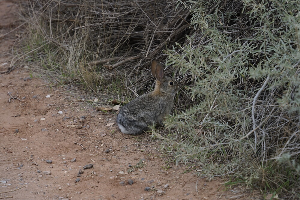
From the visitor center, one can take a hike on the Watchman Trail, so I decided to do so. Not even 5 minutes into the trial, I had my camera taking a picture of a bunny, and at that moment my camera latched with some error message. Turns out the camera decided to permanently close shut. I walked back to the visitor center to try to see if I can fix it. No matter how much I moved (gently) around the shutter mechanism to try to unlatch it, or wiggling the camera, it was stuck shut. So that was very lovely, my only SLR was out of commission for the rest of the trip. Thankfully it was near the end-ish of my trip where I would want to take pictures (2 more days essentially), so I was at least grateful that it didn’t crap out during the first couple of days. I think the bunny was just cursed.
Putting my camera away for good in my backpack, I still walked along the Watchman Trail. It was…a climb. I tried to hurry up a little as it was approaching sunset. Thankfully I reached the end of the trail by then, which had a nice overlook of the park. There I stayed with others who were also there to stare at the sunset. I would highly recommend this view for anyone in the park during sunset.
Walking back, I headed to the hotel. The camera was still stuck shut no matter what I tried, so there I truly know the camera was lost for the trip. That night I walked to the Scout Bar & Grill restaurant nearby for dinner, and got a burger. As per the previous night, expensive ish, but expected for the area. The burger was good though, and so were the fries. As I believe, good fries should taste good absent of any condiments, and these ones surely did.
Day 12 - A nothing day
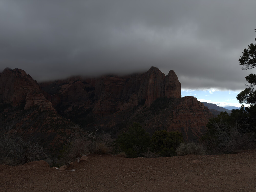
The next day, as I basically visited all the trails I wanted in the main park, and the weather wasn’t too great (foggy and cold), I decided to drive away into the Kolob Canyon section of the park. You see the main area of the park, where one associates with Zion, is only a portion of the overall National Park territory, and there was another drivable section an hour away from the “main park”. Reaching Kolob, I drove up to the Kolob Canyons Viewpoint parking. By the elevation I was at, the cold and fogginess got worse. There was even a super small amount of snow particles falling down. I initially started the walk alongside the Timer Creek Overlook Trail, but as I was the only one on the trail, and I think I heard unknown noise 5 minutes in, I got scared rushed back to the car. It didn’t help that on the trail entrance in the main bulletin, there was a warning against mountain lions in the area. So I noped out of there. I already planned the day before for this day to be a nothing-burger, so I wasn’t too disappointed.
I decided to head down to the city of St.George and see what was around. After some driving around, I went for lunch. I was initially going to go to a generic Chick-Fil-A, but I saw a sign for a buffet called Chuck-A-Rama. With a name like that, how could I resist? The food was pretty good for a buffet, although I wish they offered more variety in the “main meal” department. After that full-filling lunch, I had the rental car car-washed. Over the trip it collected dust, so I did not want to return the car in a dusty state, especially as they could nick that against me if it’s especially bad. I also took that time to vacuum the car.
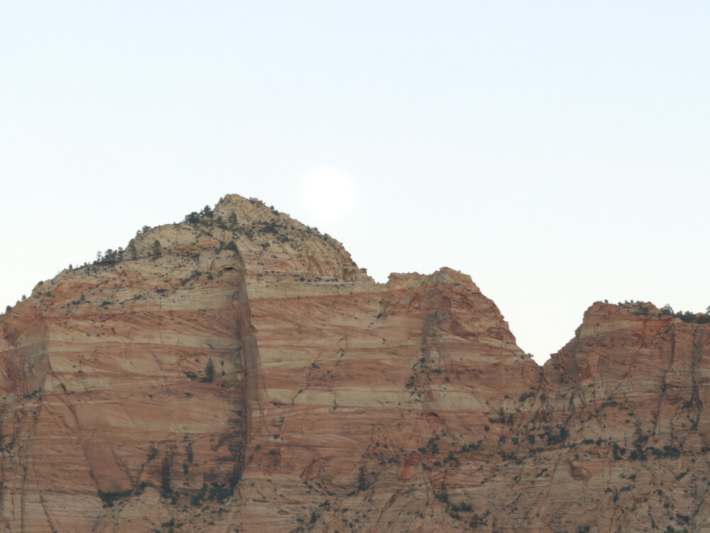
After that, I headed to the hotel to relax. This was after all mostly a nothing-burger day. I did see this lovely view of the moon over the mountain at my hotel. That was another thing that is lovely about the hotel I stayed at: it had a wonderful view of the park.
Day 13 - Drive to Vegas Valley of Fire
The next day I packed up and started my drive back to Vegas, the final destination on my trip. Before I actually drove into the city, I headed to the Valley of Fire State Park, which was along the way near I-15. The road to the park after the highway exit, Route 169, was an interesting road. It drove through a bunch of small towns, and the road was more rectangular in nature with 90 degree turns along the way.
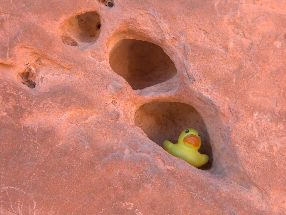
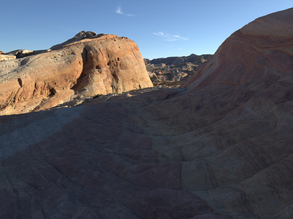
The entire park was interesting, with all sort of different rock shapes, most were red or white. Many rocks, especially ones I saw at the Seven Sisters rocks, had many holes, probably due to the way they were formed. I does make for a nice spot for Duck to sit in and relax.
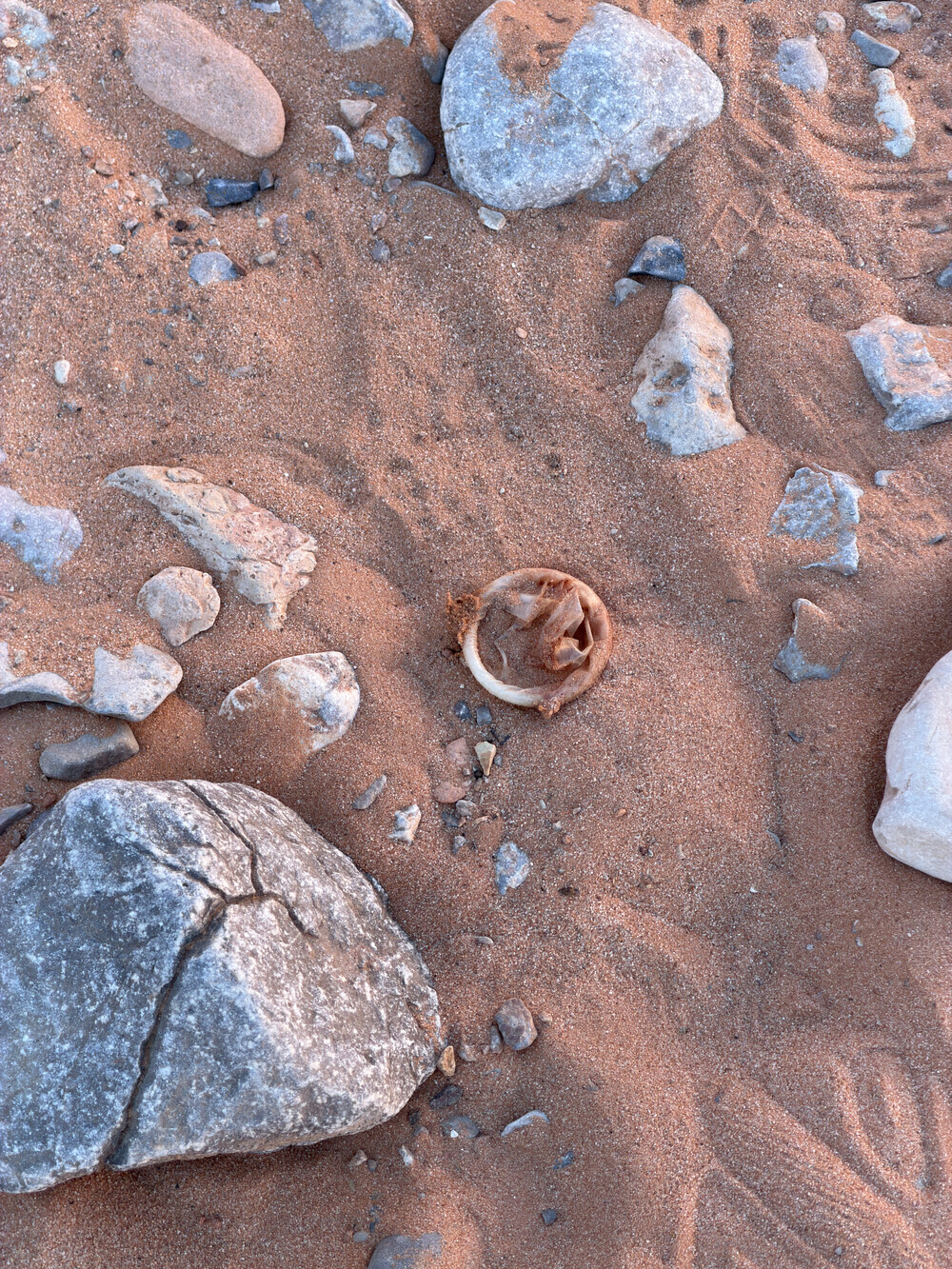
Along the way, which I see on my photo gallery as I am writing this post in Mid-March but forgot about, was I saw a condom thrown in the park. Who, how, and why, I do not know. I swear some people are absolutely selfish to the point of hurting their environment.
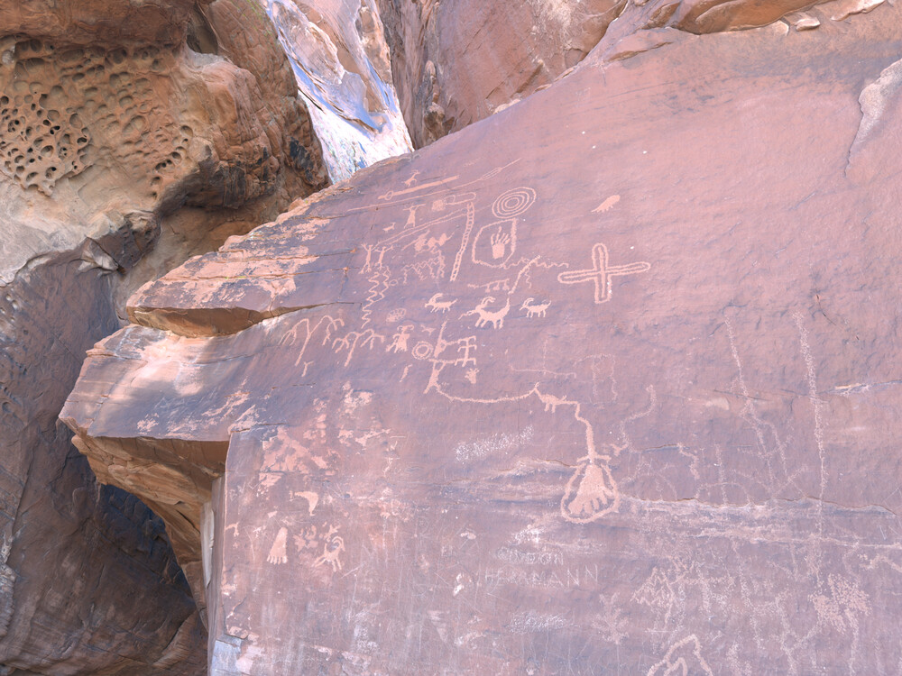
On one of the stops, Atlatl Rock, there was some ancient petroglyphs left by an older civilization. A cool historical relic of the past. Unfortunately some idiots thought it was a lovely idea to vandalize the glyphs. God I hate people sometimes.
After more driving from that point, actually to the end of the park on the west side and driving back, I went to the Rainbow Vista Trail. The trail was initially sandy along the way, making a more difficult trail, but later turned into a rock trail. At the end of that trail there was a nice secluded area where I sat and relaxed for a bit.
After that I drove to a parking lot near the White Dome Loop (the second to last parking, the Fire Wave Trail parking), and walked along the Firewave Trial on the west looking at a map, took a left at the intersection where it would cross to the White Dome loop, and made a giant circle back to the lot from the east side. The trail was an interesting walk, having to walk over all sort of interesting looking rocks, and interesting narrows to walk through.
After that I drove up to the White Dome parking lot, but didn’t fully walk the trail there. It was approaching sunset, and the park made it a rule where no cars should be in the park after. Given I was new to the park, I did not know how strict or not they were with that rule. Seeing the white dome was still a lovely stop to make.
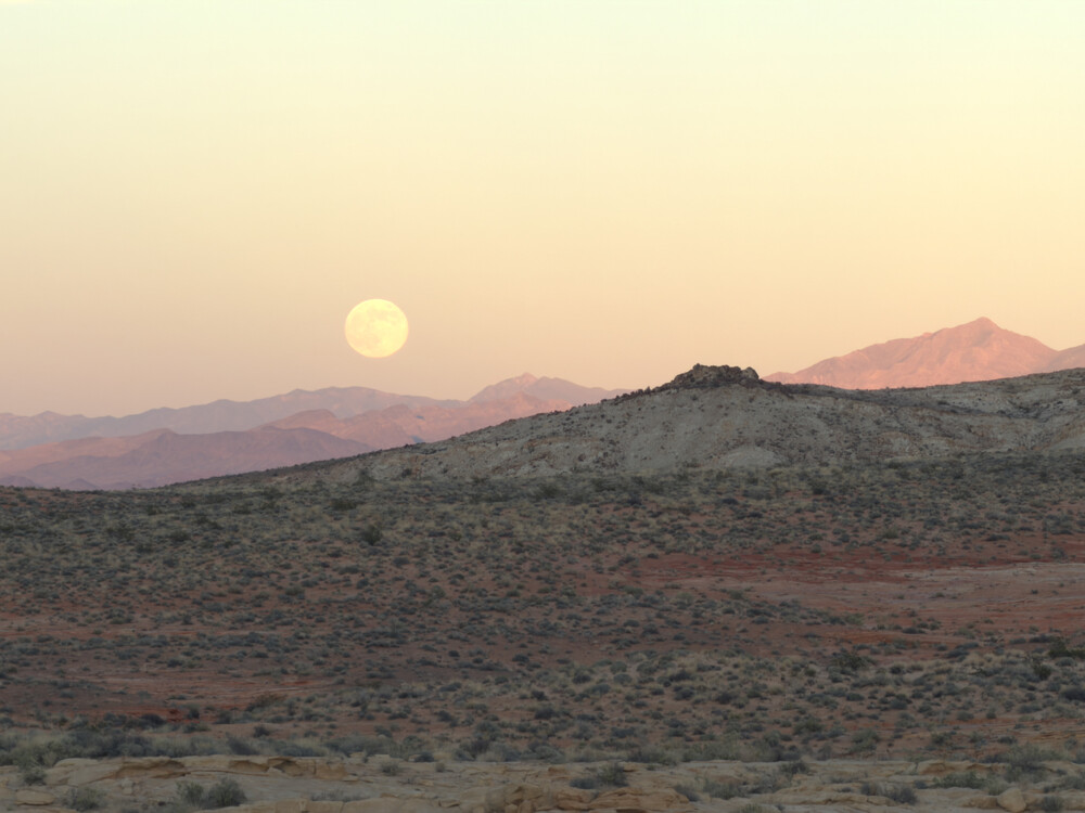
On the drive back, I noticed the moon rise up to my left, which created this lovely view that I had to stop by for.
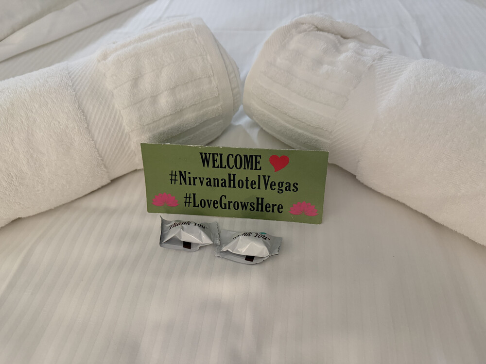
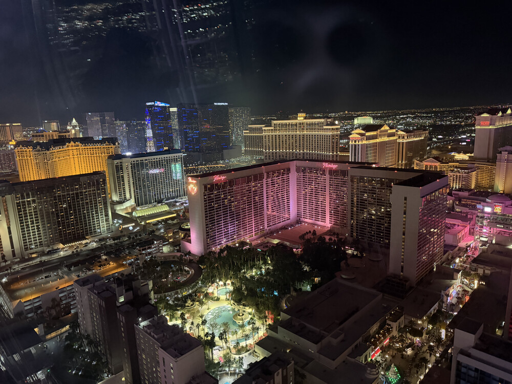
After that I drove to Vegas. It was a wonderful view driving into the city at night, arriving on a blob of light in the middle of nowhere. The hotel I stayed at was Nirvana Hotel. I actually booked it during the trip. It is a small hotel tucked near the end of the casino giants. It was so small in operation the person that greeted me wasn’t the receptionist, as they closed, but the hotel security guard. He had the names of all guests that were due, so he showed my my room, give me the unlock key, and told me to visit the receptionist the next day to actually check in. Nice guy. The presentation of the bed was quite nice.
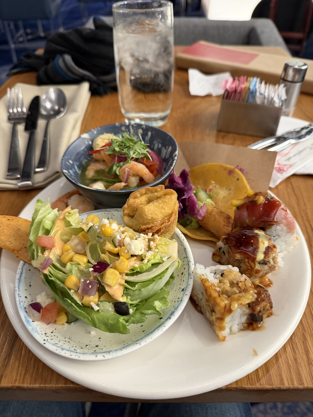
At this point I was hungry, so looking around where to eat, I decided upon the buffet a Ceasar’s Palace. I had to rush-walk there though: they were closing at 21:00, I walked out of the hotel around 19:15, but the walk was 45 minutes, and I wanted time to eat. Walking along the strip was neat, seeing where all the gambler’s money went to in presentation. Arriving at the casino and walking through, I spent 5-10 minutes trying to see where the buffet was at, I was slightly mis-directed by the signs above. Finding the buffet though, I payed for my seat and finally sat. The buffet was super expensive, at a whopping 90$, but it was some of the best buffet food I had. Many things were hand-prepared, and all were delicious.
It is worth the 90$ for my first time, but that is a steep price to pay. Especially as they give you a 1.5 hour limit. In my case it didn’t matter as that was about the amount of time to closing, but still. If I am paying 90$, I would prefer to stay the whole day ideally.
After that, I walked around the casino. It is both fascinating and sad how quickly one throws around (and ultimately wastes) hundreds down the drain. Walking into the shopping portion of the casino, it is well decorated with greek-style architecture. Even small details had that styling applied, like the benches were made to look like a fallen pillar.
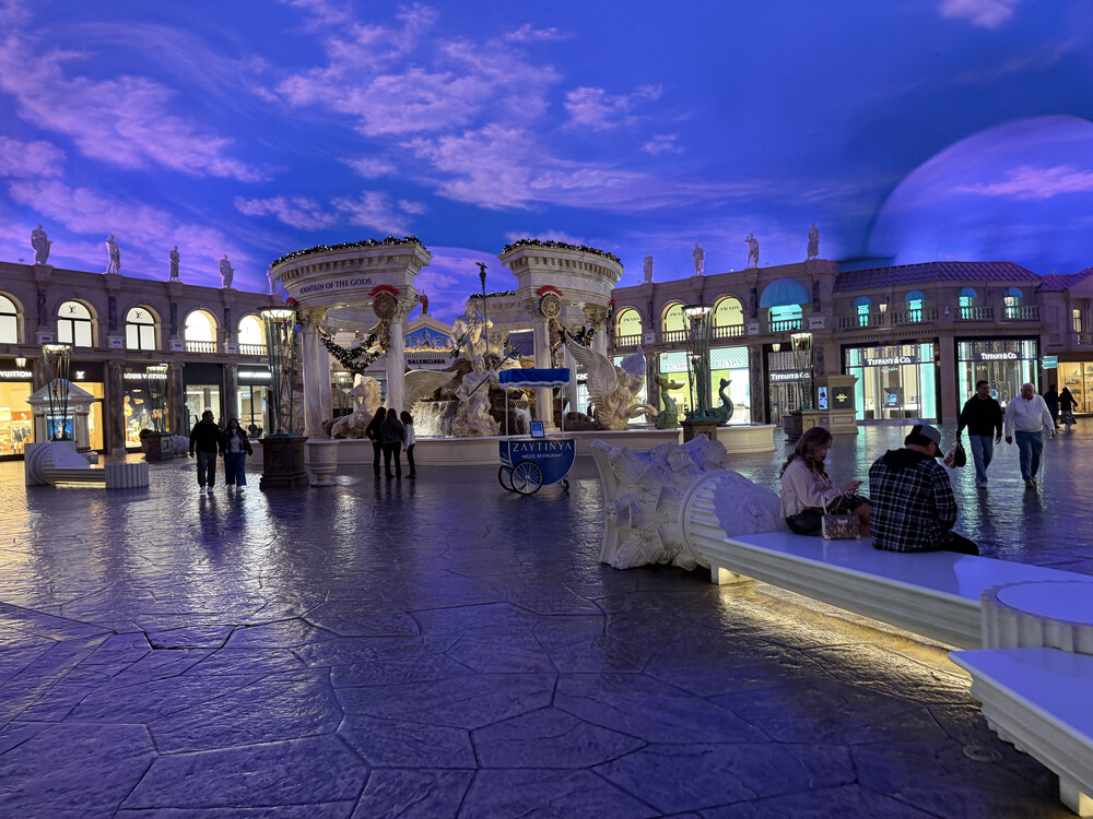
Walking back to the hotel, this time with a slower pace as I wasn’t in a rush, the entires strip was still alive 23:00 into the night. It’s almost like Manhattan, but with more lights and degeneracy.
Day 14 - Vegas!
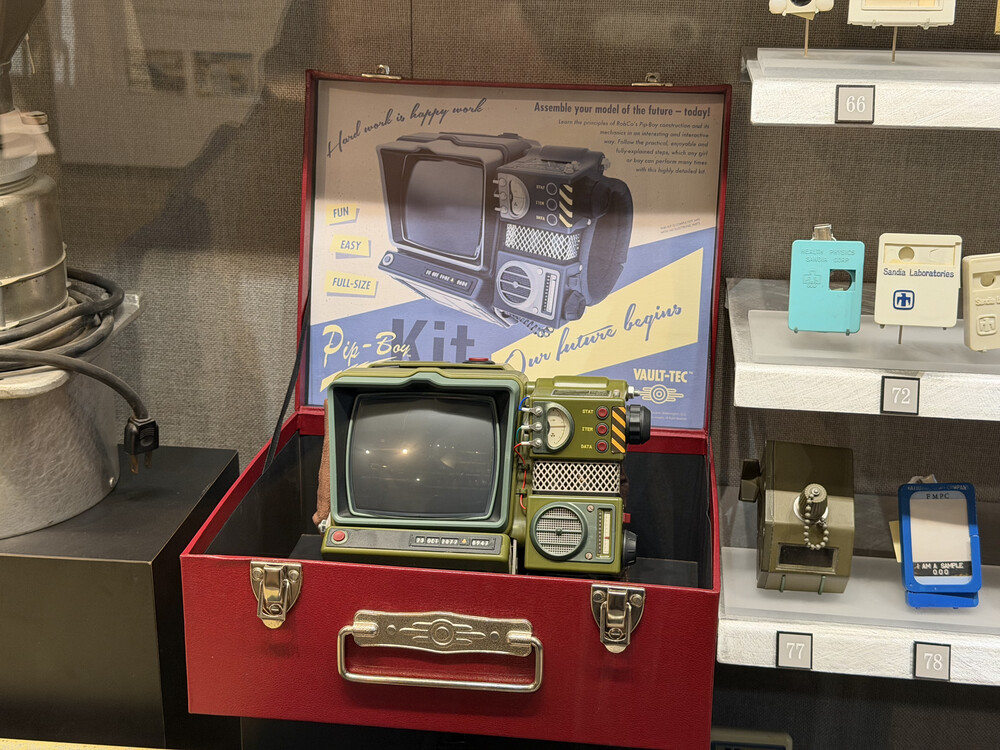
This day, I headed to the Atomic Museum. The museum was mainly about the development of the atomic bomb, it’s history and the ramification and further testing after WW2 during the cold war. It was also mentioned how due to public backlash, many future testing of bombs (i think in the 60’s and beyond) had to go underground rather than above ground, and there were some interesting engineering challenges behind that. The museum showcased info about the high-speed cameras they used to capture the bomb to analyze stuff like the fireball. This included camera that was used when the bomb was tested inside a chamber underground. The museum also collaborated with Fallout (the game) and dedicated a portion of the museum to talk about the game’s in-game history and showcased cool props, like the PipBoy. The museum also had a life-size model of the Fat Man bomb, so that was cool to see in person.

After that, I decided to drive back ot he hotel and walk along the strip again. This time I walked through various casino to see what each one was decorated like on the inside. This is the day I also decided to gamble at roulette, with a whole 15$. My strategy was to pick even or odd, and keep betting on it no matter what. I initially put down 10$, was able to make that into 30$, but after more playing lost it all. I put down an additional 5$ at a different table, just to loose it all. I can’t say I was surprised, but I can see how one may be hooked to the idea of winning. Unfortunately that is only an illusion. Another fun tidbit I learned, in Roulette 00 and 000 aren’t actually considered to be even, nor odd, which tilts the favor for the casino. As an engineer I call bullshit, but alas.
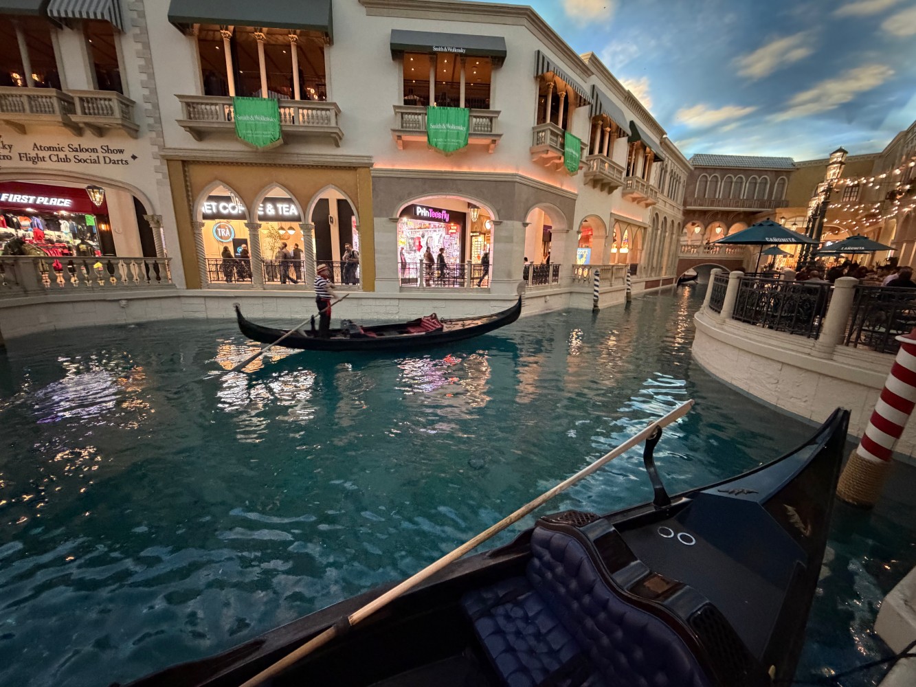
Other things of interest was Hershey World. It wasn’t as big or expansive as the “real” hershey world in Hershey, PA. It also didn’t include the Lime KitKat which I loved, which I would have bought. The river in the Venetian is real, and fascinating they their built all of this in a casino. Again, goes to show how much money flows around. Apparently Netflix has a physical restaurant? I did not go inside, but never know.
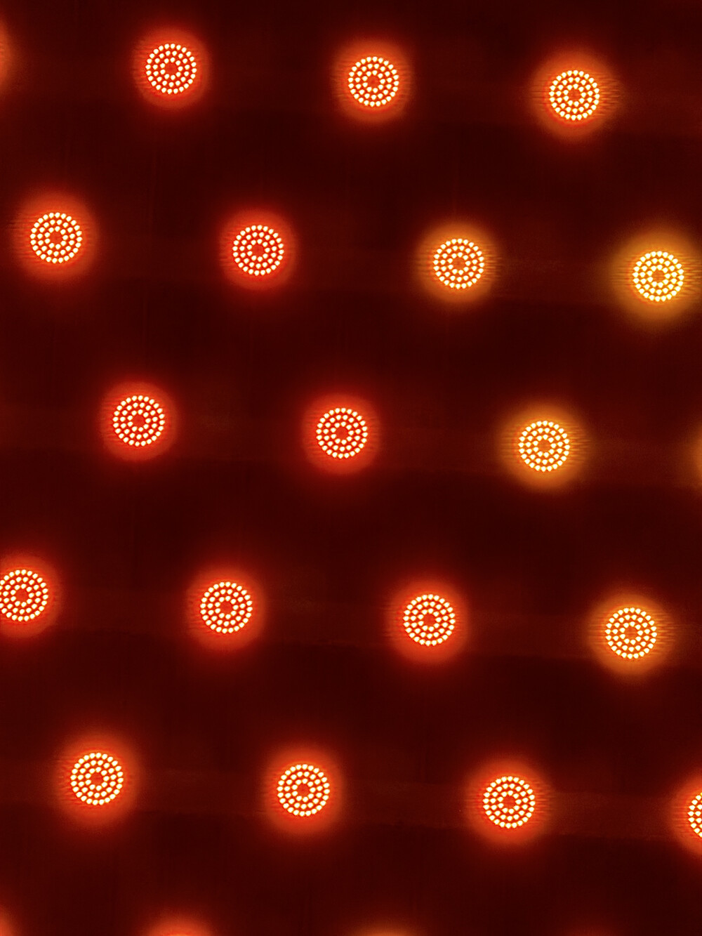
I did take the Vegas monorail from MGM and stopped by The Sphere. I though one can go inside just to see the architecture, but nope. The whole thing seems to be a giant theater with tickets at the time for the Wizard of Ozz. One interesting thing about the sphere is up close, each “pixel” is really a circular assembly of LEDs. I am sure this is to ensure if one LED craps out that the pixel is still “working”. I wonder if there any diagnostics on those pixel assemblies, like a open or short circuit indicator, to let whoever maintains the Sphere to do up-keep before the entire pixel array goes out.
I did ride the High Roller ferris wheel near the Flamingo casino. Before I rode though, turns out my Leatherman tool wasn’t allowed on, and I could not give it to security at the ferris while to hold on while I rode. I was directed to go to the Flamingo casino itself and give it to them for storage. So that was a 15-20min ordeal of walking back and forth. On the walk there was a long, like super long, wait for some show at a bar? Not sure, but I don’t understand how one has the patience for it. On the wheel itself, about halfway up, one can see the entire Strip. This was a nice way for me end the trip as this was my last day here. On the wheel there was a livestreamer streaming, which I tried to avoid their camera. They did seem respectful of not putting me on camera, so that was nice, and I didn’t mind them talking as much.
Day 15 - Flight Out
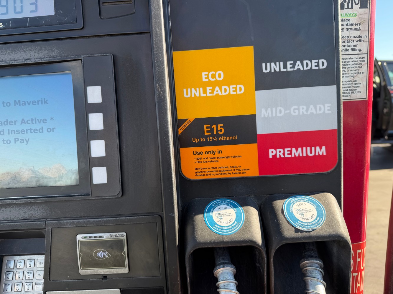
This was the final day, with this being just a travel day. I went and topped up the car’s gas before returning it. This is also the first station I saw an “eco unleaded” option, which just included more Ethanol than usual.
And that was it for this trip!
After trip notes
As I am writing the majority of this point in mid March, some time has passed.
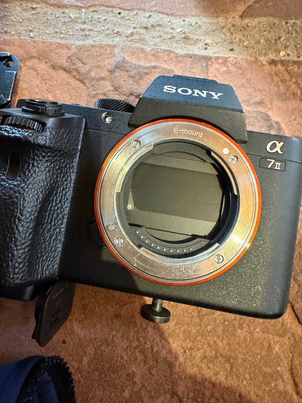
First, I was able to fix my camera. I had to disassemble the whole thing apart to get to the shutter mechanism. Thankfully, Sony, through third-part downloads, made a whole repair manual with step-by-step how to disassemble the camera, with every step included exploded views and every screw labeled. It was the only way I was able to be successful in my repair. Whoever made the call in Sony to make that document, that was the right now. I think every equipment should make something similar, so we have the Right-To-Repair our stuff (semi-pun very much intended). On the repair, I though I would have to replace the shutter mechanism. But all I had to do was to move a mechanism around, and the thing unlatched. I tried getting it to latch again, but I couldn’t. I put the camera together, and it worked! So far no issues.
One thing I want to make note of, while I did travel during Thanksgiving due to the extra time off during work at that time, the downside was sunset was around 5pm. This caused many things to be cut off early, especially as my trip was more nature focused. It didn’t help that I am not a morning person at all. It was still an enjoyable trip nevertheless.